
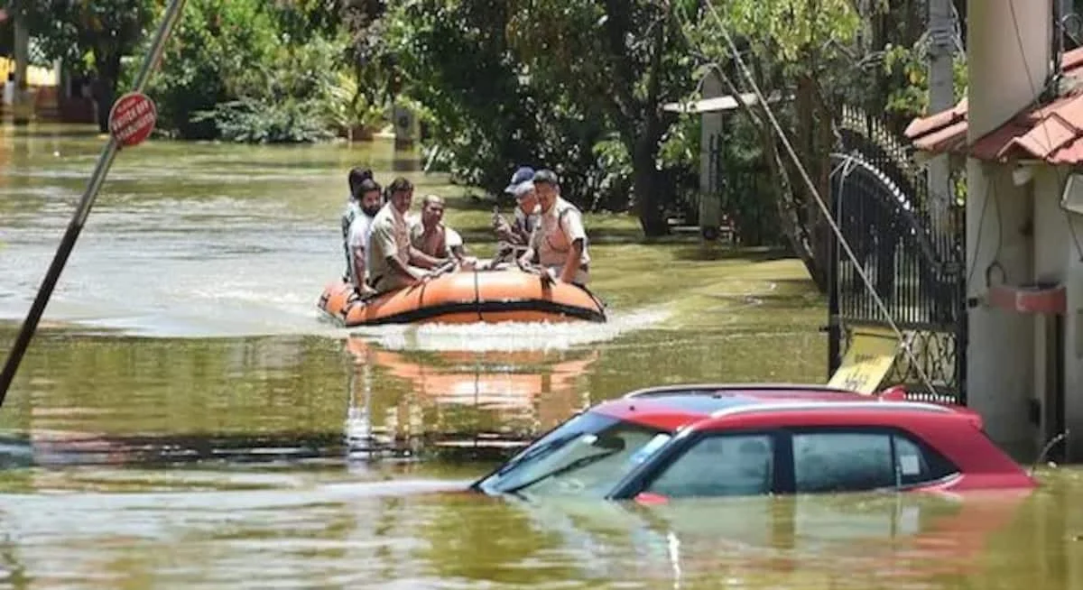
BENGALURU – For decades, Bengaluru was celebrated as India’s "Garden City," a temperate haven of sprawling parks and interconnected lakes. Today, it is better known as the nation’s Silicon Valley—a bustling, high-tech metropolis that powers the global digital economy. However, this rapid transformation has come with a staggering environmental cost. As concrete replaces canopy, the city has found itself increasingly paralyzed by a recurring nightmare: devastating flash floods that turn tech parks into lakes and arterial roads into rivers.
In a landmark effort to solve this man-made crisis, researchers from the CSIR Fourth Paradigm Institute and the Academy of Scientific and Innovative Research (AcSIR) have developed a sophisticated "digital twin" of the city’s most vulnerable drainage basins. Utilizing the United States Environmental Protection Agency’s (EPA) Stormwater Management Model (SWMM), the team has created a high-resolution hydrological simulation that offers a roadmap for flood mitigation. Their findings, recently published in the prestigious journal Natural Hazards, provide a scientific blueprint for an embattled city administration.
The Main Facts: A City Under Siege by Its Own Growth
The flooding in Bengaluru is not merely a natural disaster; it is an "engineered" one. Over the past thirty years, the city has seen an unprecedented surge in impervious surfaces—roads, rooftops, and pavements—that prevent rainwater from percolating into the ground. When extreme rainfall events occur, particularly under the influence of unpredictable climate patterns like El Niño, the runoff has nowhere to go but into the city’s aging and often inadequate stormwater drainage system.
The research focused specifically on the Koramangala-Challaghatta (KC) Valley, a 299-square-kilometer watershed in the city’s southeast. This area is home to some of the world’s largest IT firms and most densely populated residential blocks. Because of its "bowl-like" topography and its reliance on a chain of cascading lakes—including Madiwala, Bellandur, and Varthur—it is the city’s primary flood-risk zone.
The newly developed SWMM-based model is a dynamic, physics-based system. Unlike older, static models, this "digital twin" can simulate the movement of water through the urban environment in real-time. By accounting for the roughness of surfaces, the slope of the terrain, and the specific diameter of drainage pipes, the model can predict exactly where and when a flood will occur before the first raindrop hits the ground.
Chronology: A History of Paralysis (2015–2024)
To build a reliable predictive tool, the researchers had to look backward. They meticulously reconstructed four of the most catastrophic rainfall events in Bengaluru’s recent history to calibrate the model’s accuracy.
- September 15, 2015: An early warning sign of the city’s failing infrastructure, where sudden evening downpours trapped thousands of commuters and flooded low-lying basements in HSR Layout and Koramangala.
- June 1, 2016: A pre-monsoon surge that demonstrated how even moderate rainfall, when concentrated, could overwhelm the "cascading tank" system, leading to the infamous frothing of Bellandur Lake.
- August 15, 2017: The benchmark for the study. On this day, the KC Valley was pummeled by 109.28 millimeters of rain within 24 hours. The result was total paralysis. High-tech business parks were submerged, and the socio-economic disruption ran into hundreds of crores of rupees.
- September 24, 2018: This event highlighted the "backwater effect," where narrowed drains caused water to surge backward into residential areas, proving that the city’s drainage was not just small, but structurally bottlenecked.
By feeding the hourly data from 26 telemetric rain gauges into their simulation for these specific dates, the researchers proved that their digital model could replicate the actual flooding with a discharge bias of only plus-or-minus four cubic meters per second. This high level of precision marks a turning point in urban hydrological planning in India.
Supporting Data: The Physics of the Digital Twin
The research stands out for its granular approach to data. The team utilized high-resolution digital elevation maps (DEMs) from India’s CARTOSAT satellite and the international Shuttle Radar Topography Mission (SRTM).
Sub-Catchment Mapping
The 299-sq-km KC Valley was not treated as a single unit. Instead, it was carved into 39 distinct sub-catchments. Each unit was assigned its own:
- Slope and landcover characteristics: Distinguishing between a paved parking lot and a rare remaining patch of vegetation.
- Infiltration rates: Using a modified Green-Ampt model to calculate how much water the soil could actually absorb.
- Manning’s Equation parameters: A mathematical way to account for surface "roughness." For instance, water flows faster over smooth concrete than over soil, and the model calculates this velocity with precision.
The Routing Engine
At the heart of the simulation are the Saint-Venant equations. These are complex, one-dimensional mathematical frameworks that allow the model to account for dynamic wave routing. In simpler terms, the model doesn’t just see water moving from point A to point B; it understands water pressure, local acceleration, and the "choke points" where drains narrow. This allows the simulation to realistically replicate "pipe surcharging"—where water is forced out of manholes because the underground pipes are full.
Official Responses and Administrative Implications
While the research is a scientific triumph, its success ultimately depends on its adoption by the Greater Bengaluru Authority (formerly the Bruhat Bengaluru Mahanagara Palike, or BBMP). For years, the city’s response to flooding has been reactive: deploying pumps after the water has already entered homes or clearing drains only after a disaster.
A Proactive Decision-Support System
The researchers argue that this model should serve as a "Decision-Support System" (DSS). By integrating real-time weather forecasts from the India Meteorological Department (IMD) into the SWMM framework, city officials could have a 3-to-6-hour head start.
"Rather than reacting blindly, the administration can use these simulations to deploy emergency response teams to specific ‘hotspots’ before the rain peaks," the study suggests. This includes pre-positioning high-capacity pumps and evacuating vulnerable residents in low-lying "slum" areas that are often hit hardest.
Targeted Infrastructure Spending
Historically, Bengaluru has spent billions of rupees on "remodelling" drains, often with mixed results. The digital twin provides a scientific basis for these investments. It identifies exactly which concrete channels are under-designed and which ones are sufficient. This prevents the wastage of public funds on arbitrary drain expansion and focuses resources on the critical bottlenecks that cause the most damage.
Challenges and Limitations: The Human Factor
Despite the model’s sophistication, the researchers were transparent about the hurdles that remain.
1. The Pace of Urbanization:
The model relies on Land Use and Land Cover (LULC) data. In a city like Bengaluru, where a new high-rise or a paved road can appear in a matter of months, even year-old satellite data can become obsolete. The researchers noted that current concrete coverage might actually be higher than what the model assumes, potentially underestimating the severity of future runoffs.
2. The "Choked" Reality of Indian Drains:
The simulation assumes that stormwater channels are structurally sound and clean. In reality, Bengaluru’s drains are frequently clogged with solid plastic waste, construction debris, and silt. These physical obstructions significantly reduce the "carrying capacity" of the drains. If a drain is 50% blocked by plastic, the most advanced mathematical model in the world will still struggle to predict the exact overflow unless the "clog factor" is manually entered.
The Path Forward: Resilience Through Science
The implications of this study extend far beyond the KC Valley. As climate change accelerates, extreme rainfall events are becoming the "new normal" for Indian metros. From Mumbai to Chennai, cities are grappling with the same transition from natural landscapes to impervious concrete jungles.
The CSIR-Fourth Paradigm Institute’s work offers a template for "Smarter Cities." By combining advanced computational mathematics with satellite imagery, urban planners can finally move away from guesswork.
In the long term, the researchers advocate for a shift toward "Green Infrastructure." The model can be used to simulate the impact of:
- Permeable Pavements: Roads that allow water to soak through.
- Urban Rain Gardens: Small, sunken green spaces designed to capture and hold runoff.
- Rainwater Harvesting: Mandating large-scale water capture at the household and corporate level to reduce the volume of water hitting the streets.
The "digital twin" of Bengaluru’s KC Valley is more than just a map; it is a survival manual. In the face of El Niño’s unpredictability and the relentless march of urbanization, science has provided a way to reclaim the city from the water. The question now is whether the city’s administrators are ready to listen to the data before the next monsoon arrives.
