
DEHRADUN — In the desolate, high-altitude reaches of the Spiti Valley, the ground beneath the feet of indigenous communities is quite literally softening. New geophysical research has revealed a sobering reality: the ancient, underground permafrost that has sustained life in India’s highest mountain villages for centuries is thawing at an alarming rate.
For the residents of Komic and Chicham—villages that sit at the precipice of human habitability—this is not merely an environmental observation; it is an existential crisis. As the "water towers" of the Himalayas begin to leak their final reserves, the survival of these unique high-mountain cultures hangs in the balance.
Main Facts: A Subsurface Crisis in the Spiti Valley
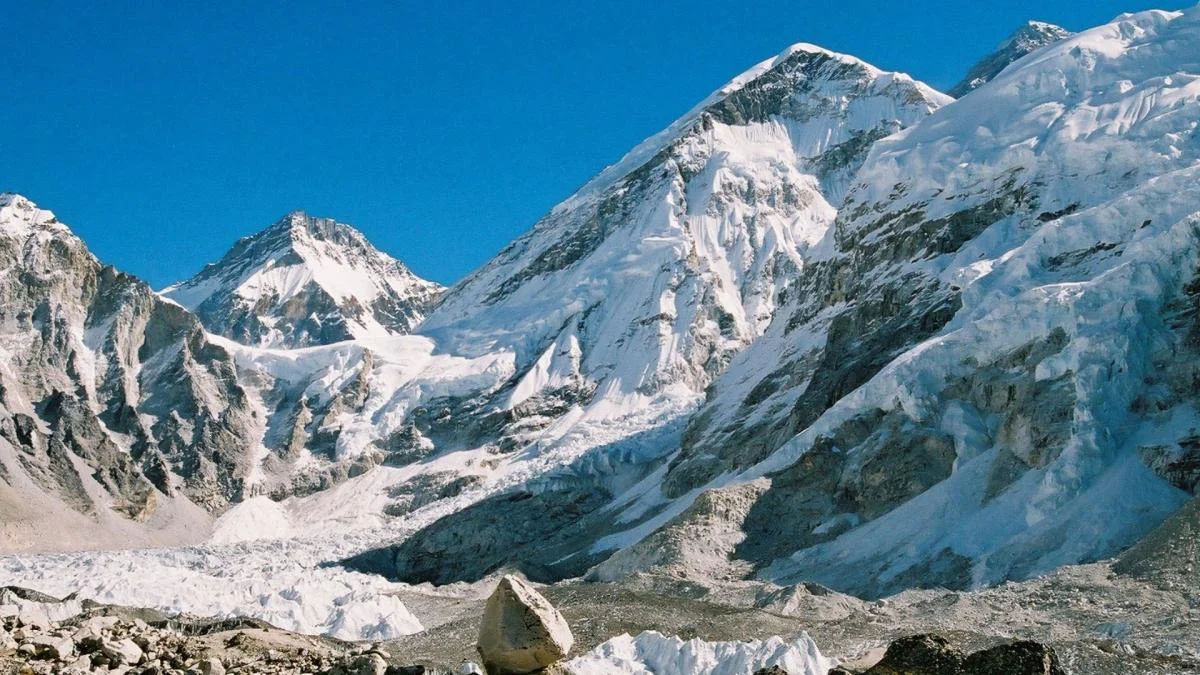
The Spiti Valley, located in the northern Indian state of Himachal Pradesh, is often referred to as a "cold desert." It is a region characterized by extreme aridity, brutal winters, and a reliance on the cryosphere—the frozen part of the Earth’s system—for every drop of life-sustaining water.
Recent scans conducted by a team of researchers have provided the first-ever three-dimensional look at the internal structure of the "relict rock glaciers" upon which these villages are built. Unlike traditional glaciers, which are massive sheets of ice visible to the eye, rock glaciers consist of a core of ancient ice insulated by a thick layer of rocky debris.
The study’s primary findings include:

- Rapid Degradation: The permafrost (ground that remains frozen for two or more consecutive years) within these rock glaciers is no longer solid.
- The "Muddy" Reality: Instead of solid ice blocks, electrical scans revealed "lens-shaped" pockets of highly saturated, muddy sediments, indicating that the ice core is turning into slush.
- Finite Water Sources: Isotopic analysis confirms that the water currently sustaining these villages is "paleo-ice"—water frozen thousands of years ago—rather than the result of recent seasonal snowmelt.
- Infrastructure at Risk: As the ice thaws, the ground becomes unstable, threatening the structural integrity of homes and the world’s highest motorable roads and bridges.
Chronology: The Migration to the Clouds
The story of Komic and Chicham is one of human resilience and adaptation in the face of a changing climate. Historically, these communities lived at slightly lower elevations where water was more accessible. However, as the lower-altitude springs began to dry up due to shifting weather patterns in the late 20th and early 21st centuries, the villagers made a strategic, albeit desperate, move.
They migrated higher up the slopes, seeking the last remaining water sources. They established their homes directly on or adjacent to landforms that appeared to be stable, rocky slopes but were, in fact, relict rock glaciers. By settling at altitudes exceeding 4,500 meters (nearly 15,000 feet), they became the highest permanent residents in the world.
For a few decades, this strategy worked. The rock glaciers acted as slow-release reservoirs, providing a steady flow of water through springs and small wetlands even during the driest months. However, the accelerating pace of global warming has caught up to these high-altitude refuges. The "relict" nature of these glaciers means they are remnants of a previous, colder era; they are not being replenished. The current thawing represents the final stage of their lifecycle, accelerated by human-induced climate change.
Supporting Data: Mapping the Invisible Thaw
To uncover what was happening beneath the surface, scientists employed a sophisticated technique known as Electrical Resistivity Tomography (ERT). This method is akin to a CT scan for the Earth. By injecting small electrical currents into the ground through metal stakes, researchers could measure how much the subsurface materials resisted the flow of electricity.
The Resistivity Signature
In the world of geophysics, ice and water have polar opposite signatures. Solid ice is a poor conductor of electricity and shows extremely high resistance. Conversely, liquid water, especially when mixed with minerals and sediment, is highly conductive and shows low resistance.

The data returned from the Spiti Valley was startling. Instead of the high-resistance "plugs" expected in healthy permafrost, the scans showed a patchwork of low-resistance zones. These "lenses" of saturated mud indicate that the permafrost is "degrading"—the scientific term for melting underground.
Isotopic Fingerprinting
To confirm the origin of the water, the research team analyzed the chemical composition of the local springs. Every water source has a unique "isotopic fingerprint" based on the ratio of heavy and light isotopes of oxygen and hydrogen.
The analysis showed that the water flowing from the springs did not match the signature of recent winter snow. Instead, it matched the signature of ancient ice. This suggests that the villages are currently "mining" a non-renewable resource. Once the ancient ice core of the rock glacier thaws completely, the springs will cease to flow, as there is no longer a sufficient "ice bank" to store and release water.
Official Responses and Scientific Limitations
While the study has sent shockwaves through the environmental community, researchers are quick to point out the technical hurdles that remain.
The Depth Limitation
The ERT method used in the survey loses its "focus" or resolution at depths greater than 40 meters. In the rugged terrain of the Himalayas, rock glaciers can be much thicker than this. This means that while scientists can see the thawing in the upper layers, the state of the deepest ice remains a mystery.

The Need for a Multi-Proxy Approach
Experts are calling for a more robust monitoring system. "Electrical scans are a vital first step, but they are not a silver bullet," noted one researcher involved in the study. To get a complete picture, future missions will need to include:
- Physical Boreholes: Drilling into the glacier to take direct temperature readings and physical samples.
- Seismic Surveys: Using sound waves to map the bedrock and deeper geology.
- Continuous Monitoring: Installing sensors that provide year-round data on water flow and ground temperature, rather than relying on seasonal "snapshots."
Local government officials in Himachal Pradesh have expressed concern, acknowledging that the state’s climate action plans must now account for "invisible" ice loss. Preliminary discussions are underway regarding the construction of "ice stupas"—artificial glaciers that freeze winter runoff to be used in the spring—as a temporary measure to supplement the failing natural springs.
Implications: A Warning for the "Third Pole"
The thawing of Spiti’s permafrost is a microcosm of a much larger disaster unfolding across the Hindu Kush-Himalaya (HKH) region, often called the "Third Pole" because it holds the largest reserve of freshwater outside the polar regions.
1. Water Security and the Indus Basin
The Spiti River is a major tributary of the Sutlej, which in turn feeds the Indus River system. Hundreds of millions of people downstream in India and Pakistan depend on the Indus for agriculture, industry, and drinking water. If the "water towers" at the headwaters fail, the impact will ripple across international borders, potentially exacerbating regional tensions over water rights.
2. The "Hidden" Disaster
Most climate attention is focused on retreating "white" glaciers. However, rock glaciers are far more numerous in the dry Himalayas. Because they are covered in rocks, their melting doesn’t look like a dramatic retreat; it looks like a mountain slowly turning into a landslide. This makes the threat "hidden" to satellite imagery, requiring labor-intensive ground surveys to detect.
3. Geotechnical Hazards
As the ice core thaws, the "glue" holding the rocky debris together vanishes. This increases the risk of "slope failure" or massive landslides. For villages like Chicham, which boasts the highest bridge in Asia, the destabilization of the ground could lead to the collapse of vital infrastructure, cutting off these communities from the outside world entirely.
4. Loss of Biodiversity and Culture
Komic and Chicham are not just coordinates on a map; they are repositories of ancient Tibetan Buddhist culture and unique high-altitude biodiversity. The disappearance of water would force a total abandonment of these settlements, leading to a "climate migration" that would erase centuries of indigenous knowledge and tradition.
Conclusion: An Urgent Call to Action
The research coming out of Dehradun and the Spiti Valley serves as a vital early warning system. It proves that the impacts of climate change are moving faster than our current infrastructure can adapt.
The residents of the world’s highest villages are the "canaries in the coal mine" for the global cryosphere. Their struggle to find water on top of melting ice is a stark reminder that even the most remote corners of the planet are not immune to the warming atmosphere.
For the planners and policymakers, the message is clear: the time for "business as usual" has passed. Safeguarding the livelihoods of these vulnerable communities requires immediate investment in climate-resilient water management, disaster mitigation, and a global commitment to slowing the thaw of the Third Pole before the ancient ice—and the civilizations built upon it—vanishes forever.
