
GANDHINAGAR, India — For decades, India’s water management policies have been built on a foundation of sophisticated computer simulations. These models dictate everything from crop insurance rates to the construction of massive dams and the allocation of interstate river waters. However, a groundbreaking study from the Indian Institute of Technology (IIT) Gandhinagar suggests that these foundations may be built on sand.
Researchers have discovered a massive "accounting error" in India’s hydrological ledger. By failing to account for the sheer scale of human-induced water loss—specifically through intensive irrigation and groundwater pumping—current models overestimate the country’s available water by as much as 50% in certain critical river basins. This discrepancy represents a "hydrological mirage" that could lead to catastrophic policy failures in one of the world’s most climate-vulnerable regions.
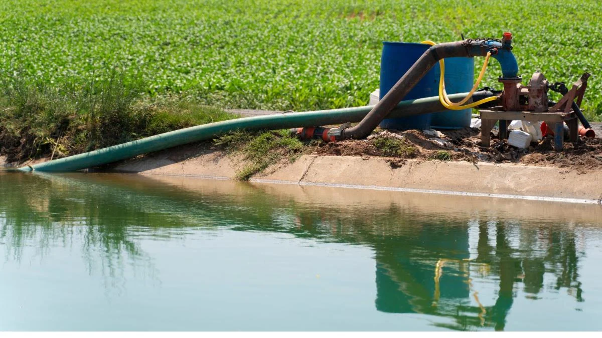
Main Facts: The Hidden Cost of the Green Revolution
The core of the issue lies in a process known as evapotranspiration (ET). In nature, ET is the sum of evaporation from the soil and water bodies, combined with transpiration from plants. It is a vital part of the water cycle, essentially representing the water that "returns" to the atmosphere.
However, in a country as agriculturally intensive as India, ET is no longer a purely natural phenomenon. Through the massive extraction of groundwater and the diversion of rivers to sustain crops during dry seasons, humans have artificially amplified this process. The IIT Gandhinagar study, which analyzed data spanning nearly two decades (2003–2020), reveals that this "Human-induced Evapotranspiration" (H-ET) is the "missing variable" that has rendered traditional hydrological models obsolete.
Key Findings at a Glance:
- The Data Gap: Current models predict an average annual water loss of 560.5 mm/year. In reality, satellite data shows the loss is 726.5 mm/year.
- Regional Extremes: In the Indus, Mahi, and Pennar basins, water availability is overestimated by more than 50%.
- Major River Impact: The Ganga, Godavari, Krishna, and Narmada basins see overestimations ranging from 30% to 40%.
- Seasonal Surge: The discrepancy is most severe during the pre-monsoon months (April to June), when human activity can account for up to 50% of all water lost to the atmosphere.
Chronology: Two Decades of Declining Reserves
The study’s timeline (2003–2020) provides a longitudinal view of how India’s water landscape has shifted. To understand how we arrived at this realization, one must look at the evolution of both Indian agriculture and global satellite technology.

2003–2010: The Widening Chasm
During the early 2000s, India’s reliance on groundwater reached unprecedented levels. As the "Green Revolution" matured, the demand for year-round farming led to the proliferation of tube wells. During this period, traditional hydrological models—which primarily look at rainfall and temperature—began to diverge from the reality on the ground. They failed to see that farmers were "mining" ancient water from deep aquifers to keep crops green during the scorching summer months.
2010–2018: The Rise of Gravity-Based Observation
The launch and maturation of NASA’s GRACE (Gravity Recovery and Climate Experiment) satellite mission changed the game. Unlike traditional satellites that take pictures, GRACE measures "mass." By detecting minute changes in Earth’s gravity, it can calculate exactly how much water mass has disappeared from a specific region. While computer models remained optimistic, GRACE began sending back data showing a rapid "lightening" of the Indian subcontinent due to water loss.
2020–Present: The Synthesis at IIT Gandhinagar
Recognizing the discrepancy between "model world" and "satellite world," researchers at IIT Gandhinagar began a multi-year synthesis. By subtracting the "natural" water loss (calculated by five different state-of-the-art hydrological models) from the "total" water loss (measured by GRACE), they were finally able to isolate the H-ET variable. The results, published recently, provide the first clear evidence that human activity is essentially "pumping" water into the sky at a rate models never anticipated.
Supporting Data: A Basin-by-Basin Crisis
The study highlights that water scarcity is not a uniform problem across India; it is a localized crisis driven by specific agricultural patterns.
The Overestimation Breakdown
The researchers categorized India’s river basins based on the margin of error found in current models:

-
The "Critical" Zone (>50% Overestimation):
- Indus Basin: As the breadbasket of the north, the Indus relies heavily on groundwater. The model failure here is most dangerous, as it affects national food security.
- Mahi and Pennar Basins: These regions show a staggering gap, suggesting that water management policies here are operating on almost entirely false data.
-
The "High Risk" Zone (30%–40% Overestimation):
- Ganga Basin: Despite being one of the world’s most powerful river systems, the Ganga is under immense pressure from H-ET.
- The Deccan Basins (Godavari, Krishna, Mahanadi): These basins support massive populations in Central and Southern India. The 30-40% error margin suggests that "Day Zero" scenarios for cities like Hyderabad or Bengaluru may arrive much sooner than projected.
The Seasonal Factor
The data shows that the "human footprint" on the water cycle is not constant. During the monsoon (July-September), the sheer volume of rain masks human activity. However, during the pre-monsoon period (April-June), the landscape undergoes a radical transformation. In irrigation-heavy regions, the H-ET becomes the dominant driver of the water cycle, accounting for nearly half of all moisture moving from the earth to the sky. This is water that is not being stored in reservoirs or recharging aquifers; it is simply vanishing.
Official Responses and the Policy Vacuum
While the scientific community has lauded the IIT Gandhinagar study, the response from policy circles has been a mix of concern and cautious evaluation. Historically, Indian water policy has been governed by the Central Water Commission (CWC) and the Central Ground Water Board (CGWB).
The Challenge for Policymakers:
Sources within the Ministry of Jal Shakti suggest that acknowledging a 50% overestimation in water availability would require a radical overhaul of the National Water Policy. "If the available ‘budget’ for water is half of what we thought, every dam project, every irrigation canal, and every crop subsidy needs to be re-evaluated," noted a senior consultant for urban water management.

The Shift Toward "Digital Twins":
The study aligns with a broader push for more advanced modeling. As seen in the recent deployment of "Digital Twin" models to predict flash floods in Bengaluru’s Koramangala-Challaghatta Valley, there is a growing realization that static models are no longer sufficient. Officials are now facing pressure to integrate real-time satellite data—like the GRACE data used in this study—into national planning to move away from "flawed" historical simulations.
Implications: A Warning for a Thirsty Nation
The implications of this study extend far beyond the laboratory. They touch upon the very survival of India’s burgeoning population and its economic stability.
1. Accelerated Aquifer Depletion
If models overestimate water, they also overestimate the "recharge rate" of aquifers. This leads to a false sense of security, allowing for the continued over-extraction of groundwater. If this continues, the deep aquifers that serve as India’s "last resort" water supply could run dry decades earlier than expected.
2. Food Security and the "Rabi" Risk
India’s ability to grow food during the non-monsoon season (the Rabi crop) is entirely dependent on the water that this study shows is being underestimated. If the water "budget" is actually 50% smaller, the current agricultural model—especially the cultivation of water-intensive crops like rice and sugarcane in semi-arid regions—is fundamentally unsustainable.
3. Climate Vulnerability
South Asia is already a hotspot for climate-driven heatwaves and erratic monsoons. When human-induced evapotranspiration is added to the mix, it creates a feedback loop. More pumping leads to more H-ET, which can alter local microclimates and potentially exacerbate the intensity of heatwaves in agricultural belts.
4. The Need for "Precision Conservation"
The study provides a roadmap for where intervention is needed most. Rather than broad, nationwide water schemes, the data suggests a need for "basin-specific" strategies. In the Indus or Mahi basins, the focus must shift immediately from "water use" to "water replenishment" and the adoption of crops that require significantly less irrigation.
Conclusion: Bridging the Gap Between Science and Survival
The work of the IIT Gandhinagar researchers serves as a stark reminder that in the era of the Anthropocene, the "natural" world no longer exists in isolation. Human activity is now a hydrological force equivalent to the sun and the wind.
By revealing that India’s available water is being overestimated by up to 50%, the study strips away a dangerous layer of complacency. The "mirage" of water plenty has been evaporated by the cold reality of satellite data. For policymakers, the choice is now clear: continue to rely on flawed models and face a future of catastrophic shortages, or embrace this new, more accurate data to build a resilient, water-secure India.
As the megacities of India continue to grow and the climate becomes increasingly unpredictable, the accuracy of our hydrological models is not just a matter of scientific pride—it is a matter of national survival. The data is in; now, the action must follow.
