

VISAKHAPATNAM – As the searing heat of the Andhra summer recedes, a quiet yet profound transformation begins to unfold across the ancient ridgelines of the Eastern Ghats. The first monsoon showers do not merely dampen the earth; they act as a master painter, stripping away the scorched, dusty browns of the dry season and replacing them with an infinite palette of emerald, moss, and forest green. For the growing community of trekking enthusiasts in North Andhra Pradesh, this meteorological shift signals the beginning of the region’s most vibrant outdoor season.
In recent years, the Eastern Ghats—long overshadowed by the towering Himalayas and the rain-drenched Western Ghats—have emerged as a premier destination for "monsoon trekking." This surge in interest is driven by a new generation of hikers seeking solitude, cooler microclimates, and a deeper connection with the indigenous landscapes of the Vizag agency areas and beyond. Guided by professional outfits such as Eco Hikes and Hikoi Adventures, these treks are redefining the relationship between the urban population and the rugged wilderness of the East Coast.
Main Facts: A Landscape Transformed by the Rain
The Eastern Ghats of North Andhra Pradesh, particularly the regions around Araku, Paderu, and Madugula, host some of the highest elevations in the entire mountain range. Unlike the dense, often impenetrable evergreen forests of the Western Ghats, the higher reaches of the Eastern Ghats (above 1,300 meters) are characterized by vast, rolling grasslands and scattered groves of fishtail palms.
The Summit Circuit
The primary draw for seasoned trekkers remains the "Big Five" of the region:
- Arma Konda (Jindhagada Peak): Standing at 1,690 meters, it is the highest point in both Andhra Pradesh and the entire Eastern Ghats. During the monsoon, it becomes a cathedral of clouds, offering views that stretch across the Odisha border.
- Sinkaram Gutta (Heaven Valley): Renowned for its aesthetic beauty, this valley lives up to its name during the rains, featuring mist-covered cliffs and ephemeral streams.
- Galikonda: One of the most physically demanding trails, offering routes ranging from 28 to 35 kilometers.
- Endric Peak: A high-altitude destination (above 4,500 feet) favored for overnight camping due to its panoramic vistas.
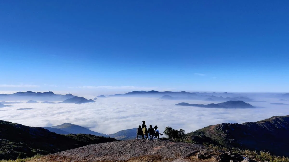
- Galikonda and Sinkaram: These peaks offer a unique "above the clouds" experience where the trekking path often sits higher than the surrounding mist layers.
Accessibility and Demographics
What was once the domain of local tribes and hardcore explorers has become accessible to a broader demographic. Guided groups now offer tiered experiences:
- Family-Friendly Treks: Short 2-to-5-kilometer walks to waterfalls like Jalada, Tamkota, and Kandulapalem.
- Expedition Grade: Multi-day summit attempts involving overnight stays in remote villages or high-altitude camps.
- Specialized Exploration: Geological treks focusing on the Gosthani river’s limestone cave systems.
Chronology: The Seasonal Cycle of the Ghats
The trekking calendar in North Andhra is dictated by the rhythm of the Southwest Monsoon. To understand the current boom, one must look at the environmental progression of the region over the year.

The Summer Stasis (March – June)
During these months, the Eastern Ghats are characterized by deciduous dormancy. The trails are dry, water sources are scarce, and the heat at lower elevations can be prohibitive. Trekking is largely restricted to early morning hours, and the landscape is prone to forest fires.
The Monsoon Awakening (July – September)
The arrival of the rains triggers an immediate biological response. Within days, seasonal streams that have been dry for eight months begin to flow. This is the peak season for waterfall treks. As Naveen Rongali of Eco Hikes observes, the higher elevations (above 1,200 meters) become a sanctuary. While the plains might experience stifling humidity or torrential downpours, the high ridges enjoy a "perpetual spring"—a mix of cool drizzles, high-velocity winds, and shifting mist.
The Winter Transition (October – February)
As the rains cease, the Ghats enter a period of high visibility and cold nights. While this is traditionally the most popular time for tourists, monsoon trekkers argue that the "soul" of the mountains is best captured during the rains, when the flora is at its most resilient and the water systems are fully recharged.
Supporting Data: The Geography of the "Cooler" Ghats
The appeal of monsoon trekking in this region is rooted in specific geographical data. The temperature differential between the coastal city of Visakhapatnam and peaks like Arma Konda can be as much as 10 to 12 degrees Celsius.
| Feature | Description | Altitude/Scale |
|---|---|---|
| Highest Point | Arma Konda (Jindhagada) | 1,690 Metres |
| Trek Lengths | Variable | 2 km (Waterfalls) to 35 km (Galikonda) |
| Vegetation Zone | High-altitude Grasslands | Above 1,300 Metres |
| Key Water Systems | Gosthani, Sharada Rivers | Seasonal/Perennial Mix |
The "grassland" ecology of the upper Eastern Ghats is a critical data point. Unlike the Himalayas, where trekking often involves navigating steep rocky moraines or snow, the Eastern Ghats offer a "soft" terrain of undulating hills. This makes the region uniquely suited for long-distance ridge walking, a style of trekking that allows for expansive 360-degree views for hours at a time.
Official and Expert Responses: Safety and Strategy
Professional trekking organizers emphasize that while the monsoon makes the mountains beautiful, it also introduces specific hazards that require expert navigation.

The Myth of the "Easy" Hike
Naveen Rongali, founder of Eco Hikes, warns against complacency. "One of the biggest mistakes is the lack of navigation skills. There is still no comprehensive network of officially marked trails in the Eastern Ghats," he notes. In the thick monsoon mist, visibility can drop to less than five meters, making it easy for solo hikers to lose their way on the expansive ridgelines.
The Safety Protocol
Vamsi Thenakani of Hikoi Adventures highlights the importance of real-time weather monitoring. "Every trek is backed by first-aid, emergency communication, and an evacuation strategy. If conditions become unsafe, we change the route or cancel. Reaching the summit is never more important than safety," he says.
Key expert recommendations for monsoon trekkers include:
- Footwear: High-grip, waterproof trekking shoes are non-negotiable to handle slippery rocks and slushy trails.
- Hydraulic Awareness: Staying away from stream beds during active rainfall. Upstream rain can cause "flash rises" in water levels even if it isn’t raining at the trekker’s location.
- Campsite Selection: Avoiding exposed hilltops where lightning strikes and high winds are risks; instead, camping near tribal hamlets for safety and support.
Implications: Ecology, Community, and the Future
The rise of trekking in the Eastern Ghats carries significant implications for both the environment and the local indigenous populations.
Cultural Exchange and the Tribal Economy
The trails often pass through the ancestral lands of the Bhagata, Valmiki, Kondadora, and Konda Dhora tribes. The monsoon trek offers a rare window into their agricultural cycle. Trekkers witness traditional farming practices that have remained unchanged for centuries.
"We work closely with local tribal communities who possess deep ecological knowledge," says Vamsi Thenakani. This collaboration provides an alternative source of income for villagers who act as guides, porters, and hosts, incentivizing the preservation of the forest over exploitative practices like podu (slash-and-burn) cultivation.

Ecological Red Flags
However, the frequent visits of trekkers have also turned them into amateur citizen scientists, documenting worrying shifts in the environment. Vamsi notes a decline in wild date plants, which were once ubiquitous at the 4,000-foot mark. Changes in flowering and fruiting cycles, likely linked to erratic rainfall patterns and rising global temperatures, are becoming increasingly evident to those who walk these trails year after year.
The "Leave No Trace" Imperative
As the popularity of North Andhra’s mountains grows, the pressure on the ecosystem increases. Both Eco Hikes and Hikoi Adventures have made "Leave No Trace" principles a cornerstone of their operations. This involves not only carrying back all non-biodegradable waste but also educating trekkers on the fragility of the high-altitude grasslands, which are easily scarred by off-road vehicles or improper camping.
Conclusion: A Call for Responsible Exploration
The monsoon in the Eastern Ghats is a fleeting, majestic window into the primal beauty of Peninsular India. It offers a sensory experience that the winter months cannot replicate—the roar of the Tarabu waterfalls at full strength, the sight of clouds "pouring" over the edges of Galikonda, and the profound silence of a mist-shrouded forest.
As North Andhra Pradesh positions itself as a hub for adventure tourism, the challenge lies in balancing this growth with ecological stewardship. The wisdom of the local tribes, combined with the professional standards of modern trekking groups, provides a roadmap for how this can be achieved. For the trekker, the reward is a reminder that some of the most spectacular landscapes on the subcontinent are not found in the distant north, but right here, waiting for the next rain to fall.
For those looking to explore these trails, Eco Hikes and Hikoi Adventures can be reached via their social media platforms (@ecohikes and @_hikoi_adventures) for seasonal schedules and safety briefings.
