

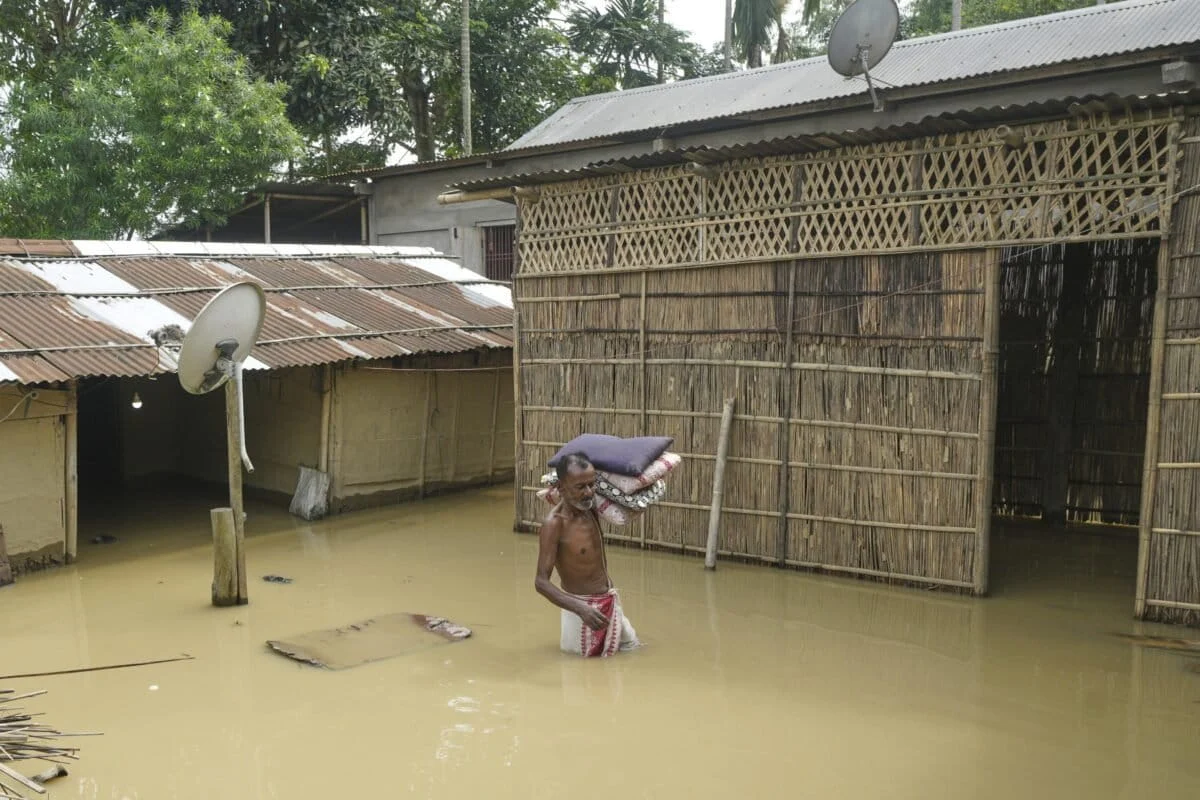
GUWAHATI, ASSAM — Between 2012 and 2022, the state of Assam endured a decade of systematic devastation that has come to define its monsoon seasons. According to official data from the National Disaster Management Authority (NDMA), the quantifiable toll is staggering: more than 2.5 million hectares of cropland submerged, over ₹400 billion (approximately $4.8 billion) in economic damages, and the loss of 1,215 human lives. Yet, experts argue that these figures represent only the tip of the iceberg, failing to capture the long-term psychological trauma, the erasure of cultural heritage, and the permanent displacement of "char" (river island) dwellers.
Despite the recurring nature of this crisis, the national response remains trapped in a reactive cycle. Each year, the script is the same: a brief surge of outrage on social media, heroic but localized relief efforts by civil society, and government promises to repair breached embankments. However, as climate change accelerates and the Brahmaputra River’s behavior becomes increasingly erratic, a growing chorus of scientists and policy specialists is calling for a fundamental shift in governance. The era of "fighting the river" with concrete must give way to a sophisticated, localized strategy of "living with the water."
Chronology of a Crisis: From Traditional Cycles to Climate Chaos
Assam’s relationship with water is historically foundational. The state sits in the heart of the Brahmaputra and Barak river basins, where heavy monsoon rains have traditionally nourished the soil. However, the intensity and frequency of these floods have reached a breaking point over the last two decades.
![Going beyond the annual flood response with district level plans [Commentary]](https://imgs.mongabay.com/wp-content/uploads/sites/30/2026/08/27130726/AP25153469734760-1200x800.jpg)
Historically, floods were viewed as a seasonal necessity for agriculture. This changed significantly following the Great Earthquake of 1950, which altered the topography of the Brahmaputra bed, making the river more prone to massive sediment deposits and erratic course changes.
In the last decade, the pattern has shifted again, driven by the global climate crisis.
- 2012: A landmark year of devastation where nearly every district in the state was submerged, leading to a re-evaluation of embankment safety.
- 2019: Massive floods displaced over 5 million people, highlighting the inadequacy of the state’s early warning systems.
- 2024-2025: Recent floods have demonstrated a dangerous new trend. Unlike previous years where the main stem of the Brahmaputra was the primary culprit, recent disasters have been triggered by overflowing south-bank tributaries. Heavy, concentrated rainfall in the hills of Nagaland and Arunachal Pradesh caused flash floods in downstream Assam districts, catching local administrations off-guard.
This evolution proves that the "hazard" is no longer a predictable seasonal guest but a volatile force shaped by regional Himalayan warming.
The Science of Risk: Hazard, Exposure, and Vulnerability
To understand why Assam remains underwater despite decades of investment, one must look at the framework provided by the Intergovernmental Panel on Climate Change (IPCC). The IPCC defines disaster risk as a function of three intersecting factors:
![Going beyond the annual flood response with district level plans [Commentary]](https://imgs.mongabay.com/wp-content/uploads/sites/30/2026/08/27131318/AP19200610119649-768x512.jpg)
- Hazard: The potential for a flood to occur, determined by rainfall intensity and drainage density. In Assam, the hazard is increasing due to erratic "cloudburst-like" events in catchment areas.
- Exposure: The number of people and assets in the flood’s path. As population density grows and urban centers expand into wetlands (beels), exposure has reached record highs.
- Vulnerability: This is the most critical and overlooked factor. It measures how badly a population is impacted based on socio-economic conditions. A 2026 study by the Indian Institute of Technology (IIT) Guwahati revealed that districts with high poverty, limited healthcare access, and a prevalence of "kutcha" (temporary) housing suffer disproportionately higher damage from floods of the same magnitude compared to wealthier districts.
Supporting Data: The Failure of the "Embankment Economy"
For over half a century, Assam’s primary defense has been the construction of embankments. To date, the state has built approximately 423 embankments spanning more than 4,800 kilometers. This strategy, managed by the Brahmaputra Board and the state’s Water Resources Department, focuses almost exclusively on creating physical barriers.
The data suggests this "grey infrastructure" approach is failing:
- Maintenance Debt: An estimated 60% of Assam’s existing embankments are currently in need of urgent repair or are structurally compromised.
- Sedimentation: The Brahmaputra carries one of the highest sediment loads in the world. As embankments confine the river, silt settles on the riverbed rather than the floodplain, raising the water level higher than the surrounding land. When a breach occurs, the resulting "velocity flood" is far more destructive than a natural overflow.
- Economic Cost: The ₹400 billion lost in a decade far outweighs the capital invested in these structures, suggesting a poor return on investment for traditional engineering solutions.
Official Responses and the Governance Gap
The official response has historically been centralized. The Brahmaputra Board develops Master Plans for the entire basin, and implementation is often tied to loans from multilateral development banks (MDBs) like the World Bank and the Asian Development Bank (ADB).
While these institutions have provided much-needed capital, critics argue their projects often double down on "engineered" solutions—concrete spurs and geo-bags—because these are easier to quantify and audit than "soft" solutions like reforestation or community resilience building.
![Going beyond the annual flood response with district level plans [Commentary]](https://imgs.mongabay.com/wp-content/uploads/sites/30/2026/08/27134513/7732197540_eecf38fcaa_3k-768x512.jpg)
Furthermore, there is a disconnect between data and action. While the state possesses District Disaster Management Plans (DDMPs), these documents are largely focused on post-disaster relief—distributing rice, salt, and tarpaulins—rather than long-term adaptation. They lack the granularity needed to address the specific physiographic and social realities of individual districts.
Implications and the Path Forward: District-Level Adaptation
The failure of centralized engineering necessitates a move toward District-Level Adaptation Plans (DLAPs). This approach acknowledges that a flood in the highlands of Dhemaji requires a different response than a flood in the plains of Dhubri.
1. Localizing Early Warning Systems (EWS)
The 2025 floods highlighted a fatal flaw in the current EWS. The system is designed to monitor gradual water level rises in major rivers. It failed to detect a sustained eight-hour bout of heavy rainfall in Nagaland’s Mon district, which devastated downstream communities in Assam. A localized plan would empower district officials to monitor micro-climatic variables and communicate directly with village heads, bypassing the bottleneck of centralized state-level data processing.
2. Nature-Based Solutions
Instead of fighting the river, DLAPs would prioritize the revival of "beels" (wetlands) and "baors" (oxbow lakes). These natural reservoirs act as sponges, absorbing excess runoff. Reforestation of catchment areas in collaboration with neighboring states like Nagaland and Arunachal Pradesh is also essential to reduce the siltation that chokes the Brahmaputra’s capacity.
![Going beyond the annual flood response with district level plans [Commentary]](https://imgs.mongabay.com/wp-content/uploads/sites/30/2026/08/27135618/36864282513_fc97571b5b_o-e1787819228571-768x512.jpg)
3. Resilient Housing: The "Chang Ghar" Model
Housing policy must evolve. In many districts, 100% of homes are damaged during the monsoon. The Assam government has proposed model housing schemes, but these must be district-specific. In many areas, the traditional Chang Ghar (stilt house) of the Mising community offers a blueprint for resilience. However, because Assam is also a high-risk seismic zone, these designs must be modernised to withstand both water and earthquakes—a task that requires local architectural integration rather than a "one size fits all" central design.
4. Redirecting Finance
The involvement of MDBs offers a unique opportunity. Rather than using World Bank or ADB loans solely for embankments, these funds should be directed into a "project pipeline" generated by the District Adaptation Plans. This would include funding for flood-resilient seeds for farmers, elevated livestock shelters, and solar-powered community hubs that remain functional during power grid failures.
Conclusion: A Paradigm Shift
Assam stands at a crossroads. The statistics of the last decade—the lives lost and the billions in damages—are a clear indictment of a governance model that treats floods as an occasional emergency rather than a permanent geographic reality.
The path to resilience lies in transparency and localization. By combining high-science hydrological modeling with the lived experience of local communities, Assam can transition from a state of perpetual victimhood to a global leader in climate adaptation. The challenge is no longer just to keep the water out, but to ensure that when the water comes, the life of the state does not come to a standstill. The time for brief social media outcries has passed; the time for systemic, district-level reform has arrived.
