

The Rann of Kutch, a vast expanse of salt marshes spanning the border of India and Pakistan, represents one of the most dynamic and geologically significant landscapes on the planet. Covering approximately 26,000 square kilometers in the western Indian state of Gujarat and extending into Pakistan’s Sindh province, it is a place defined by transformation. Every year, this "white desert" disappears beneath the tidal currents of the Gulf of Kutch and monsoon rains, only to re-emerge as a shimmering, crystalline wasteland as the waters recede.
Beyond its seasonal beauty, the Rann is a graveyard of ancient civilizations, a laboratory for seismologists, and a hard-fought home for indigenous salt farmers. This article explores the multifaceted history, the tectonic forces that sculpted its terrain, and the modern environmental challenges that threaten its delicate equilibrium.
1. Main Facts: A Landscape of Duality
The term Rann is derived from the Hindi word for salt marsh, while Kutch refers to a land that is alternately wet and dry. This duality is the region’s defining characteristic. The Rann is geographically divided into two primary sections: the Great Rann and the Little Rann.
Seasonal Metamorphosis
During the monsoon months, the Rann is transformed into a shallow inland sea. Tidal surges from the Arabian Sea mix with freshwater runoff, creating a brackish environment that attracts thousands of migratory birds. Most notably, flamingos arrive in massive flocks to feed on brine shrimp and hatch their young on the "Flamingo City" mudflats. However, as the summer heat intensifies, the water evaporates, leaving behind a crust of salt and minerals that stretches to the horizon.
![A salt marsh through time [Commentary]](https://imgs.mongabay.com/wp-content/uploads/sites/30/2026/05/14125046/Asiatic_Wild_Ass_at_sunset-1200x800.jpg)
Biodiversity and Conservation
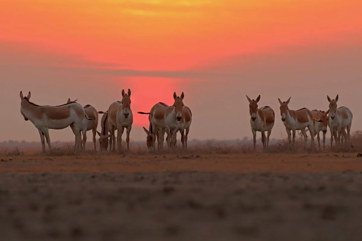
Despite its harsh conditions, the Rann is a critical biodiversity hotspot. It is the last refuge of the Indian Wild Ass (Equus hemionus khur), protected within the Indian Wild Ass Sanctuary in the Little Rann. The region also hosts the Chhari Dhand Wetland Reserve, a vital stopover for over 370 species of birds. The ecosystem relies on a precise balance of salinity and water depth, a balance that is increasingly under pressure from human activity.
The Salt Economy
The Rann of Kutch is the backbone of India’s salt industry. Gujarat produces roughly 76% of the nation’s salt, with the Little Rann alone contributing nearly one-third of that total. This production is driven by the Agariyas, a community of traditional salt workers who have lived on these flats for centuries, practicing a form of solar evaporation that is as much an art as it is a labor.
2. Chronology: From Ancient Seas to Tectonic Upheavals
The history of the Rann is a timeline of gradual geological shifts punctuated by violent tectonic events.
- 4,500 Years Ago (The Harappan Era): During the peak of the Indus Valley Civilization, the Rann was a navigable arm of the sea. The ancient city of Dholavira, located on Khadir Bet (an island in the Rann), was a thriving port. Harappan settlers utilized the waterways for trade with Mesopotamia, suggesting the Rann was much deeper and more connected to the ocean than it is today.
- 326–325 BCE (Alexander the Great): Historical records from Alexander’s campaign in the Indus Delta describe a landscape of treacherous sea-level variations and vast tidal flats. At this time, the Rann was still a shallow sea inlet, though sedimentation from the Indus River system had begun the long process of infilling.
- 712 CE (The Arab Conquest): Chroniclers of the Arab invasion of Sindh noted that while the sea remained navigable, it was becoming increasingly shallow. Over several centuries, the delta expanded, and the Rann began its transition from a permanent marine environment to a seasonal salt marsh.
- June 16, 1819 (The Great Earthquake): This is the most pivotal date in the Rann’s modern geological history. At approximately 6:50 p.m., a massive earthquake struck the region. It caused a 80-kilometer-long stretch of land to rise by three to five meters, creating a natural dam that blocked the Nara (Puran) River. This feature was named the "Allah Bund" (Mound of God) by local survivors.
- 1830s (Geological Recognition): Sir Charles Lyell, the father of modern geology, cited the 1819 earthquake in his seminal work Principles of Geology. He used the Allah Bund as a primary example of how earthquakes can instantaneously reshape the Earth’s crust, marking a watershed moment in the science of seismology.
- January 26, 2001 (The Bhuj Earthquake): Another catastrophic seismic event struck Kutch, killing thousands and destroying infrastructure. This earthquake reinforced the region’s status as a high-risk seismic zone and highlighted the resilience of traditional architectural forms like the bhunga.
3. Supporting Data: The Mechanics of a Changing Earth
The Rann of Kutch is one of the most seismically active regions in India, situated near the boundary where the Indian Plate continues its northward push into the Eurasian Plate.
![A salt marsh through time [Commentary]](https://imgs.mongabay.com/wp-content/uploads/sites/30/2026/05/14125341/White_salt_desert_at_Rann_of_Kutch-768x512.jpg)
The Allah Bund Phenomenon
The 1819 earthquake was one of the first historically documented instances of surface faulting. While the northern side of the fault rose to form the Allah Bund, the southern side subsided. This subsidence caused the Sindhri Fort, a vital customs outpost, to sink into the ground, eventually becoming submerged as the sea rushed in to fill the newly created depression.
Liquefaction and Sand Blows
Geoscientists have identified extensive evidence of "liquefaction" in the Rann—a process where saturated soil loses its strength and behaves like a liquid during intense shaking. This created "sand blows" or "sand volcanoes," many of which remain preserved in the arid environment as geological markers of past tremors.
Socio-Economic Statistics
The Agariya community consists of roughly 10,000 families who migrate to the Rann for eight months of the year. They live in makeshift shacks without electricity or running water. Despite their contribution to the national economy, many Agariyas lack formal land titles, leaving them vulnerable to displacement by large-scale industrial salt and chemical corporations.
4. Stakeholder Perspectives and Official Responses
The future of the Rann of Kutch is a subject of intense debate among government agencies, environmentalists, and indigenous communities.
![A salt marsh through time [Commentary]](https://imgs.mongabay.com/wp-content/uploads/sites/30/2026/05/14130703/Rann_of_Kutch_-_White_Desert-scaled-e1778744291562-768x512.jpg)
Industrial Expansion vs. Traditional Rights
The Gujarat government and large industrial houses see the Rann as a frontier for economic growth. Large-scale brine extraction by corporations often lowers the water table, making it harder for Agariyas to pump the saline water they need for their small-scale pans. Community leaders argue that the "industrialization of the desert" ignores the traditional rights of salt workers who have sustained the landscape for generations.
The Green Energy Dilemma
In a bid to meet India’s renewable energy targets, the Rann is being transformed into a hybrid renewable energy park. Massive tracts of land are being covered with solar panels and wind turbines. While this supports global climate goals, local ecologists express concern. The hyper-saline air of the Rann is highly corrosive; experts warn that solar panel structures may degrade rapidly, potentially leaching heavy metals into the soil and disrupting the nesting grounds of migratory birds.
Conservation Efforts
The Forest Department and various NGOs manage the Indian Wild Ass Sanctuary. There has been a long-standing tension between conservationists and salt workers, as the sanctuary’s boundaries overlap with traditional salt-farming areas. However, recent initiatives have begun to recognize the Agariyas as "guardians of the Rann," acknowledging that their presence can help deter poachers and monitor the health of the ecosystem.
5. Implications: A Precarious Future
The Rann of Kutch stands at a crossroads where geological volatility, climate change, and industrial ambition converge.
![A salt marsh through time [Commentary]](https://imgs.mongabay.com/wp-content/uploads/sites/30/2026/05/14125912/Greater_Flamingos_at_Rann_of_Kutch-768x512.jpg)
Climate Change Vulnerability
The Rann is hyper-sensitive to changes in weather patterns. Climate change has made the Indian monsoon more erratic. Unseasonal rains in March or April—previously rare—now frequently occur, dissolving the salt crystals in the Agariyas’ pans just weeks before harvest. For a family that relies on a single annual crop, one day of unseasonal rain can mean a year of debt.
Lessons in Resilience
Humanity has adapted to this volatile landscape in remarkable ways. The bhunga, a circular mud hut with a conical thatch roof, is a masterpiece of indigenous engineering. Its shape allows wind to flow around it and seismic waves to dissipate without collapsing the structure. During the 2001 earthquake, while modern concrete buildings in Bhuj crumbled, many ancient bhungas remained standing. This traditional knowledge offers a blueprint for resilient living in disaster-prone areas.
The Path Forward
The story of the Rann of Kutch is a reminder that landscapes are not static. The very forces that cause destruction—earthquakes and floods—are the same forces that created the Rann’s unique ecology and mineral wealth.
To preserve this "ephemeral giant," future development must be community-led and ecologically sensitive. Whether it is the protection of the Wild Ass, the rights of the Agariyas, or the structural integrity of new green energy projects, the Rann requires a management strategy that respects its history as a place where the earth literally breathes and shifts. As geoscientist CP Rajendran notes, the Rann is a place of "elemental significance," and its survival depends on our ability to coexist with its restless nature.
