

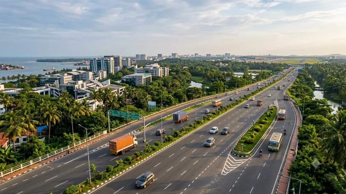
For any commuter who has navigated the gridlock of Vytilla or the perennial bottlenecks of Edappally, the struggle of Kochi’s urban transit is a lived reality. As Kerala’s commercial capital continues its rapid expansion, the traditional road networks have often found themselves overwhelmed by the sheer volume of intra-city traffic and heavy industrial freight. It was against this backdrop of urban congestion that the Seaport-Airport Road (SPAP Road) was conceived. Originally envisioned as a dedicated industrial corridor, it has evolved into the city’s most critical economic artery, reshaping the geography of Ernakulam and fueling a multi-billion-rupee real estate and IT boom.
Main Facts: A Corridor of Strategic Importance
The Seaport-Airport Road is a 25.7-kilometer-long highway designed to provide a seamless link between the Cochin Port at Irumpanam and the Cochin International Airport (CIAL) at Nedumbassery. Managed by the Roads and Bridges Development Corporation of Kerala (RBDCK), the project serves a dual purpose: it acts as a high-speed bypass for heavy container traffic while simultaneously serving as the primary access route for Kochi’s burgeoning Information Technology (IT) and industrial sectors.
A Multi-Modal Gateway
Unlike standard state highways, the SPAP Road is a multi-modal facilitator. On its southern end, it services the massive oil terminals and petroleum cargo hubs of Irumpanam. As it moves north, it traverses the administrative and technological heartland of Kakkanad, before terminating near the international airport. This makes it one of the few stretches in India that directly links a major maritime port, a special economic zone (SEZ), a massive IT park, and an international aviation hub.
Engineering Specifications
While currently a mix of two-lane and four-lane segments, the ultimate vision for the road is a fully signal-free, four-lane divided highway. The road is engineered to sustain the heavy axle loads of container trucks moving from the Vallarpadam International Container Transshipment Terminal (ICTT) and the BPCL Kochi Refinery, ensuring that industrial logistics do not interfere with the daily commute of the city’s white-collar workforce.
Chronology: From Concept to Contemporary Challenge
The history of the Seaport-Airport Road is a saga of ambitious planning met with the complex realities of land acquisition and urban expansion.
Phase 1: The Foundation (2000–2003)
The first phase of the project, spanning approximately 11.3 kilometers from Irumpanam to Kalamassery (HMT Junction), was completed in the early 2000s. This phase was revolutionary for the city, as it successfully diverted heavy tankers and trucks away from the congested NH 544 and city centers. It immediately became the preferred route for those traveling from the southern districts of Kerala toward the industrial belt of Ernakulam.
The Stagnation Period (2005–2018)
Following the success of Phase 1, the project hit significant hurdles. The extension from Kalamassery to Nedumbassery (Phase 2) faced decade-long delays due to land acquisition disputes. The route required passage through land held by central government entities, specifically the Hindustan Machine Tools (HMT) and the Naval Armament Depot (NAD). Negotiations between the State Government and the Ministry of Defence/Ministry of Heavy Industries remained in a stalemate for years, leaving the road in a "half-finished" state that ended abruptly at Kalamassery.
Phase 2: Recent Resurgence (2019–Present)
In recent years, a renewed political will and the pressing need for better airport connectivity have breathed new life into the project. The state government successfully navigated the land transfer protocols with the NAD and HMT. Currently, work is progressing on the extension toward the airport, with sections near Mahilalayam and Chowwara seeing active construction. The completion of the "missing link" between Kalamassery and the airport is now a top priority in the state’s infrastructure agenda.
Supporting Data: The Socio-Economic Catalyst
The Seaport-Airport Road is more than a transit route; it is the foundation upon which "New Kochi" is being built. The data surrounding its impact on the region’s infrastructure is staggering.
The IT and Industrial Powerhouse
The road serves as the primary entrance to Infopark Kochi and SmartCity Kochi, which together house over 600 companies and employ upwards of 100,000 professionals. The proximity of the road to the Cochin Special Economic Zone (CSEZ) further solidifies its status as a commercial powerhouse.
- Logistics Efficiency: Industrial units in the Ambalamughal-Irumpanam belt report a 30-40% reduction in transit time to the airport since the partial opening of the SPAP Road.
- Traffic Volume: Estimates suggest that the road handles over 40,000 Passenger Car Units (PCUs) daily, a number expected to double once Phase 2 is fully operational.
Educational and Healthcare Infrastructure
The corridor has attracted top-tier institutions, creating a "Knowledge Hub" along its stretch.
- Education: Major institutions such as the Cochin University of Science and Technology (CUSAT), Rajagiri School of Engineering and Technology, and Model Engineering College are located within a 2-km radius of the road.
- Healthcare: The road provides critical emergency access to Rajagiri Hospital and Sunrise Hospital, serving as a lifeline for residents in the eastern suburbs who previously had to travel into the city center for multi-specialty care.
Public Transit Integration
The road is no longer an isolated highway; it is being integrated into Kochi’s "Grid Power" transit system.
- Kochi Metro Phase 2: The upcoming "Pink Line" of the Kochi Metro, which will connect Jawaharlal Nehru Stadium to Infopark, will run parallel to segments of the Seaport-Airport Road, creating a seamless multi-modal interchange.
- Water Metro: Feeders from the Kakkanad Water Metro terminal are designed to utilize the SPAP Road to transport commuters to the IT parks, creating a unique water-road-rail synergy.
Official Responses: Addressing Growth Pains
Government officials and planners acknowledge that the road’s success has also brought challenges, primarily in the form of traffic saturation and safety.
The Four-Laning Mandate
The Kerala State Government, through the RBDCK, has announced a comprehensive plan to upgrade the existing two-lane stretches to four lanes. An official from the Public Works Department (PWD) noted, "The exponential growth of Kakkanad as an IT hub was faster than anticipated. We are now fast-tracking the four-laning of the Bharata Mata College to Collectorate stretch to alleviate peak-hour congestion."
Safety and Infrastructure Upgrades
Following concerns raised by local residents and safety advocates regarding street lighting and pedestrian crossings, the local municipalities (Thrikkakara and Kalamassery) have initiated projects to install high-mast lights and CCTV surveillance. There is also a plan to introduce "smart signaling" at major junctions like HMT and Infopark to manage the complex mix of heavy trucks and commuter two-wheelers.
Environmental and Land Concerns
Officials have also had to address the environmental impact of the Phase 2 extension. The government has committed to a "green corridor" approach, ensuring that the expansion toward Nedumbassery minimizes the impact on local water bodies and paddy fields, utilizing elevated spans where necessary.
Implications: The Real Estate Boom and Future Urbanization
The most visible impact of the Seaport-Airport Road is the radical transformation of Kochi’s real estate landscape.
The Rise of the "Eastern Corridor"
Historically, Kochi’s development was concentrated along the coast and the NH 66 bypass. The SPAP Road has shifted the city’s gravity eastward. Areas like Kakkanad, which were once considered "remote outskirts," are now the most sought-after residential and commercial addresses in the state.
- Residential Appreciation: Property values along the Seaport-Airport Road have seen an estimated capital appreciation of 200% over the last decade. High-rise luxury apartments and gated villa communities now dominate the skyline.
- Commercial Diversification: Beyond IT, the road has become a hub for high-end automobile showrooms (Mercedes-Benz, BMW, Audi), retail hypermarkets, and corporate headquarters that prefer the visibility and accessibility of the highway over the cramped city lanes.
Future Outlook: A Global City Vision
As Kochi aspires to become a global tech hub, the completion of the Seaport-Airport Road is non-negotiable. The road is the primary link for the proposed Gift City (Global Industrial Finance and Trade City) at Ayyampuzha.
The long-term implication is clear: the Seaport-Airport Road is transforming Kochi from a mono-centric city into a polycentric urban sprawl. By connecting the port (the city’s history) with the airport and IT parks (the city’s future), the road ensures that Kochi remains competitive on a global scale.
Conclusion
The Seaport-Airport Road Kochi is more than just a convenience for frustrated drivers; it is a strategic asset that defines the economic trajectory of Central Kerala. While Phase 2 remains a work in progress, the road’s existing impact on IT, logistics, and real estate is undeniable. Once the final kilometer is paved to Nedumbassery, the SPAP Road will complete its transformation into a world-class corridor, finally providing Kochi with the high-speed connectivity its residents and businesses deserve. For investors, residents, and planners alike, all roads in Kochi now lead to—and through—the Seaport-Airport corridor.
