By [Your Name/Journalist Name]
PUDUCHERRY — Every morning at 1:00 a.m., while the rest of the Union Territory of Puducherry remains shrouded in darkness, 75-year-old Kannachiamma begins her workday. She travels eight kilometers to the Karaikal harbour to purchase the day’s catch. By 4:00 a.m., she is at a fish-drying center near her village, meticulously cleaning and salting fish before spreading them across a concrete floor.

For Kannachiamma, this 300-square-meter patch of concrete on Mandapathur Road is more than just a workplace; it is her lifeline. "There is no profit really, but on a good day, I might earn ₹1,000. That is how I survive," she says.
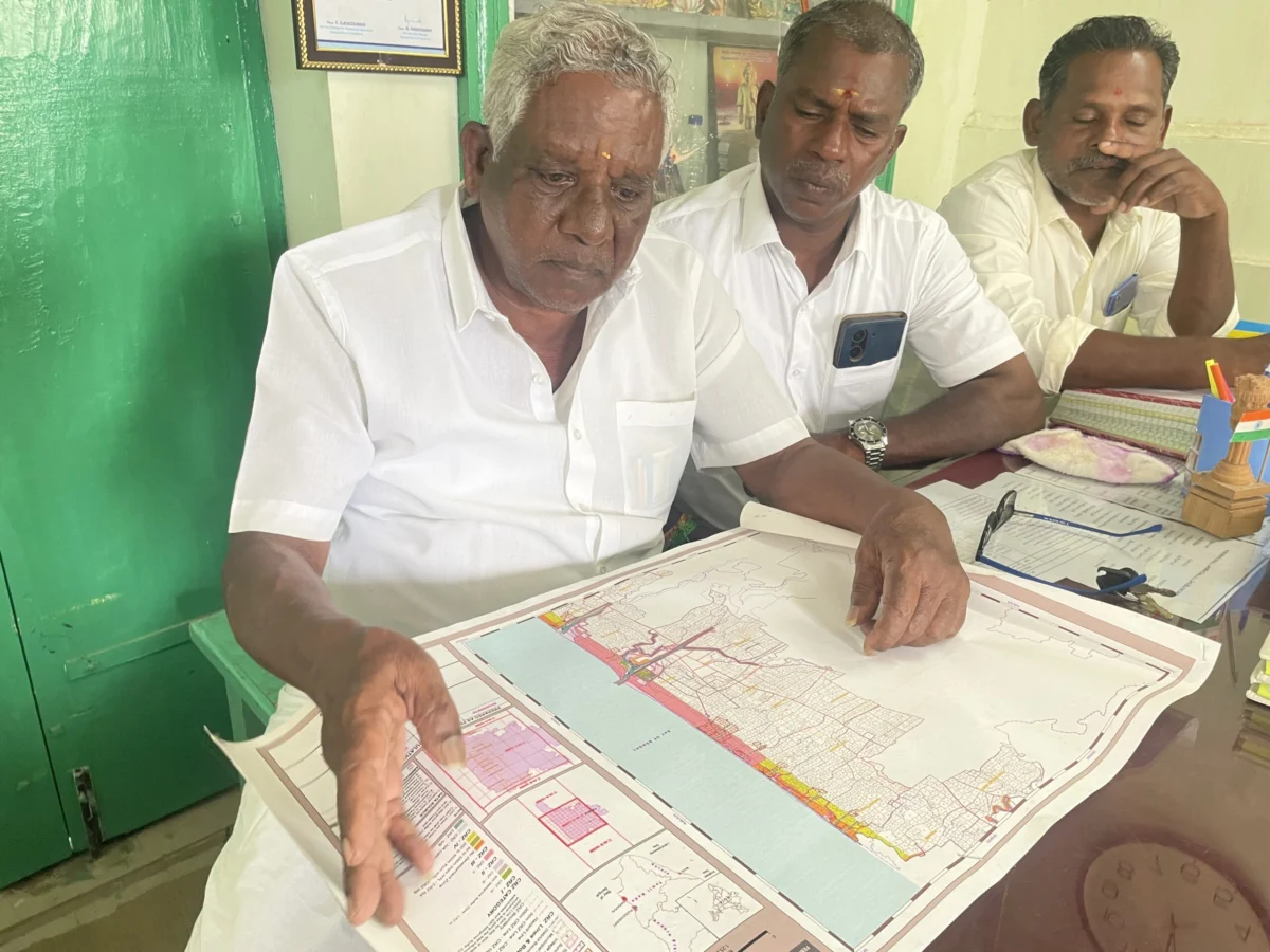
However, according to the official maps currently being drafted to govern India’s coasts, Kannachiamma’s drying center—and the livelihoods of thousands of women like her—effectively does not exist. A brewing conflict over the Coastal Zone Management Plans (CZMP) in Puducherry and Karaikal has highlighted a critical flaw in India’s environmental governance: a "scale paradox" that renders local communities invisible while clearing the path for industrial expansion.
Main Facts: The Scale of Invisibility
The Coastal Regulation Zone (CRZ) notification is the primary legal instrument intended to protect India’s fragile 7,500-kilometer coastline. It categorizes land up to 500 meters from the high tide line into specific zones, each with varying levels of protection and permitted activity. The execution of these rules depends entirely on Coastal Zone Management Plans (CZMP)—detailed maps that determine where a hotel can be built, where a port can expand, and where a fishing village is protected.

The core of the current dispute lies in the technical scale of these maps. The Union Ministry of Environment, Forest and Climate Change (MoEFCC) mandates that CZMPs be drawn at a scale of 1:25,000. At this resolution, a single grid square on the map covers approximately 196 square kilometers.
For coastal residents, this scale is disastrously "zoomed out." Small but vital commons—fish-drying platforms, boat repair yards, net-mending sheds, and even entire clusters of traditional housing—are smaller than a pinprick at 1:25,000. Consequently, they are often omitted from the draft plans. While the CRZ notification also requires the creation of "cadastral" or local-level maps at a 1:4,000 scale, these are not subject to the same public scrutiny and are frequently never produced for public use.
Chronology: A History of Protest and Procedural Impasse
The struggle for accurate mapping in Puducherry has been a multi-year saga of administrative friction and grassroots resistance:

- 1991–2019: The CRZ notification undergoes dozens of amendments. Critics argue these changes have consistently prioritized tourism, real estate, and port development over the customary rights of fisherfolk.
- 2018: Public hearings for the 2011 CRZ notification draft are held. Despite 19 formal representations from the community highlighting errors, the final plans reportedly ignore the feedback.
- March 2023: The government releases a new draft map for Puducherry and Karaikal based on the 2019 CRZ notification. Large stretches of the Karaikal beach are marked as "tourism zones," while traditional fishing villages are left unnamed.
- 2023 (Mid-year): Fishing communities, led by the Coastal Peoples’ Right to Life Movement (CPRM) and traditional fisher panchayats, boycott public hearings in protest.
- July 2024–July 2025: Following the boycott, a rare collaborative mapping exercise occurs. Mapping experts, community organizers, and government officials work with fisher panchayats to document villages and commons.
- April 2024: A second draft is issued. While it includes some villages, it continues to exclude critical eco-sensitive areas like mangroves and sand dunes.
- May 2024: M. Malayalathan, a resident of Veerampattinam, approaches the National Green Tribunal (NGT), seeking to squash the maps as incomplete and contrary to CRZ guidelines.
- August 2024: An independent report by ecologists and GIS experts reveals that official data from the National Centre for Sustainable Coastal Management (NCSCM) missed 70–90% of eco-sensitive areas in the region.
- August 2025: The NGT disposes of the case after the government promises to create a new draft incorporating community concerns.
- Present Day: Six months after the NGT ruling, community leaders report a total "blackout" of communication from the Puducherry Pollution Control Committee (PPCC).
Supporting Data: The Coastline Paradox
The mapping issue is compounded by a geographical phenomenon known as the "coastline paradox." Because coastlines are irregular, the measured length of a coast increases as the measurement scale becomes finer.
India’s official coastline length recently "increased" from 7,500 kilometers to nearly 11,100 kilometers. This change occurred because the new estimate used a scale of 1:250,000, which captured more crevices and curves than the 1970s estimate of 1:4,500,000.
However, even the 1:25,000 scale used for CZMPs fails to capture the "fluid engagement" communities have with the coast. For a developer, the beach is a static plot of land. For a fisherman, it is a parking lot for boats, a workshop for nets, a playground for children, and a defensive buffer against storms.

Data compiled by the CPRM in August 2024 found that official maps missed over 1,200 acres of eco-sensitive zones. In Puducherry, where 57% of the coast is already suffering from erosion, these omissions are not merely clerical errors—they are ecological risks.
Official Responses and Institutional Hurdles
Government bodies, including the Puducherry Pollution Control Committee (PPCC) and the Puducherry Coastal Zone Management Authority (PCZMA), have maintained in court filings that all eco-sensitive areas have been marked. However, they have struggled to explain why the 1:4,000 local maps—which would show individual properties and commons—remain largely inaccessible to the public.
Zaman Ali, an environmental lawyer, notes a systemic bias in how these maps are generated. "Private project proponents, such as hotel developers, often hire the NCSCM to create specialized 1:4,000 maps just for their project areas," Ali explains. "We often see a sudden change where an area previously marked as a highly protected intertidal zone (CRZ-I B) is re-categorized as a less-protected zone (CRZ-III B) based on these private, high-resolution maps."

When fishing communities attempt to access the same level of detail through Right to Information (RTI) requests, they are frequently told the maps are "yet to be prepared." This creates a two-tiered system of coastal governance: high-definition mapping for industry, and low-definition "invisibility" for traditional residents.
Implications: Climate Change and the Right to the Coast
The failure to accurately map the coast has dire implications for climate resilience. As sea levels rise and extreme weather events become more frequent, the lack of recognized commons makes coastal communities more vulnerable to displacement.
In December 2025, the Ditwah cyclone brought heavy rains and winds to Puducherry. In the village of Veerampattinam, a large stretch of the beach was swept away. "The sea took away an entire row of fishing nets," says R. Arumugam, a local fisherman. Because these areas are not officially recognized as "fishing commons" in the CZMP, seeking compensation or protection for the land becomes a legal nightmare.

Furthermore, the 2011 and 2019 CRZ notifications both mandate that state governments create long-term housing plans for fisher communities to account for population growth and disaster preparedness. To date, no such plan has been finalized in Puducherry.
"The state should take steps to acquire land for long-term housing rather than diverting it for tourism or SEZs," says Jesu Rathinam, an activist and lawyer. "Coastal land is not just property; it is livelihood infrastructure."
Conclusion: The Need for Community-Centric Planning
The impasse in Puducherry is a microcosm of a national crisis. Only five states and union territories in India have approved CZMPs under the 2019 notification. In almost every instance—from Goa to Tamil Nadu—the delay is rooted in community protests over missing villages and commons.

For women like Kannachiamma, the technicalities of map scales and NGT filings boil down to a simple question of survival. If the concrete patch where she salts her fish is eventually replaced by a "tourism zone" or a "no-development zone" that doesn’t recognize her presence, her 1:00 a.m. routine comes to an end.
The solution, according to experts, is a shift toward participatory mapping where the 1:4,000 scale is the starting point for public consultation, not an afterthought. Until the government acknowledges the "minute details and crevices" of coastal life, the maps will continue to represent a coastline that exists on paper, but ignores the people who live upon it.