

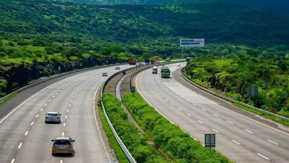
BENGALURU — In a move set to fundamentally alter the logistical and economic landscape of Southern India, the National Highways Authority of India (NHAI) is nearing the realization of the Bengaluru-Vijayawada Economic Corridor. This ambitious infrastructure project, designated as National Highway 544G (NH-544G), is poised to bridge the gap between two of the region’s most vital urban centers, cutting travel time by nearly four hours and reducing the physical distance between the cities by approximately 110 kilometers.
As of June 2026, construction is progressing at a rapid pace across multiple districts. With a significant portion of land acquisition completed and critical environmental clearances secured, the six-lane, access-controlled greenfield highway is being hailed as a "game-changer" for both passenger transit and industrial freight.
Main Facts: A Strategic Link Between Economic Hubs
The Bengaluru-Vijayawada Expressway is not merely a road project; it is a strategic economic artery. Currently, commuters and logistics operators must navigate congested routes that often take upwards of 10 to 12 hours depending on traffic conditions. The new corridor is designed to provide a high-speed, seamless alternative.
Key Project Highlights:
- Total Distance Reduction: The project will shorten the route between Bengaluru and Vijayawada from the current distance to a more direct path, saving 110 km.
- Time Efficiency: Travel time is expected to drop significantly, with officials estimating a saving of three to four hours for the entire journey.
- Greenfield vs. Brownfield: The project comprises a 343.24 km greenfield section (built on entirely new land) and a 190 km brownfield component (upgrading existing roads).
- Investment Scale: In the Kadapa district alone, the project involves an investment exceeding Rs 5,377 crore across six construction packages.
- Connectivity: The highway acts as a vital bridge between NH-44 (the North-South corridor linking Bengaluru to Hyderabad/Srinagar) and NH-16 (the East Coast corridor linking Chennai to Kolkata).
Chronology: From Blueprint to Reality
The journey of NH-544G has been one of meticulous planning and regulatory navigation. The project was conceived under the Bharatmala Pariyojana, the government’s flagship infrastructure program, to address the missing links in India’s highway network.
- Initial Proposal: Conceived as part of the Bengaluru-Kadapa-Vijayawada Economic Corridor to alleviate pressure on existing state highways and national arteries.
- March 2025: A pivotal month for the project. The NHAI secured Stage-II forest clearance and wildlife clearance. These statutory approvals were essential, as the route passes through sensitive ecological zones in Andhra Pradesh.
- Late 2025 – Early 2026: Land acquisition entered its final stages. Of the 2,750 hectares required for the entire corridor, the vast majority has been secured and handed over to contractors.
- June 2026 (Present): Construction is in full swing. The project is divided into 14 distinct packages to ensure parallel progress across different geographical segments.
Supporting Data: The Geography of Growth
The expressway is meticulously planned to pass through five key districts in Andhra Pradesh, bringing modern infrastructure to several hinterland regions that have historically lacked high-speed connectivity.
Route Alignment and Districts
The highway originates near Kodur village at the Kodikonda check-post (on the Karnataka-Andhra border) and terminates at Muppavaram village near Addanki. The 343 km greenfield stretch traverses:
- Sri Sathya Sai District
- YSR Kadapa District
- SPSR Nellore District
- Prakasam District
- Bapatla District
The Kadapa Focus
While the entire corridor is significant, YSR Kadapa district is emerging as the primary beneficiary. The highway spans 123.5 km within this district alone, cutting through 12 mandals:
- Pulivendula, Vemula, Vempalli, VN Palli, Yerraguntla, Kamalapuram, Chapadu, Mydukuru, B Matham, B Kodur, and Porumamilla.
To facilitate local movement and regional integration, the NHAI has planned 17 interchanges along the entire route, seven of which are located within Kadapa. This ensures that the "access-controlled" nature of the highway does not isolate the communities it passes through, but rather integrates them into the national economy.
Technological and Safety Specifications
The project incorporates an Advanced Traffic Management System (ATMS). This includes:
- CCTV Surveillance: Continuous monitoring of traffic flow and incident detection.
- Variable Message Signs (VMS): Real-time updates for drivers regarding weather, accidents, or speed limits.
- Closed Tolling System: In a departure from traditional toll plazas, the corridor will implement a system where motorists are charged only for the specific distance traveled, utilizing GPS-based or RFID technology to ensure fairness and reduce congestion at entry points.
Official Responses: Government and Stakeholder Perspectives
Local and state officials have expressed high confidence in the project’s ability to catalyze development.
Sridhar Cherukuri, Kadapa District Collector, emphasized the administrative efficiency that has brought the project to this stage. "The land acquisition process is nearing completion, with over 1,020 hectares acquired in Kadapa district alone. With an investment of over Rs 5,300 crore in this segment, we are looking at a massive infusion of capital that will create jobs and improve local infrastructure."
From a political and industrial standpoint, R Srinivasa Reddy, a prominent TDP leader and zonal coordinator for Hindupuram and Ananthapuram, highlighted the industrial synergy the road creates. "This corridor provides a direct, high-speed link between the industrial nodes of Hindupuram and the emerging hub at Kopparthi in Kadapa. By linking these zones to Bengaluru and the ports via Vijayawada, we are creating a logistical powerhouse."
NHAI officials have also noted that the "Greenfield" nature of the project allows for straighter alignments and fewer curves, which is the primary reason for the 110 km reduction in distance compared to existing "Brownfield" routes that must follow historical village boundaries and winding terrain.
Implications: Beyond Just a Road
The completion of the Bengaluru-Vijayawada Expressway carries profound implications for the socio-economic fabric of Southern India.
1. Industrial Deceleration of Congested Hubs
By improving connectivity to towns like Pulivendula and Mydukuru, the expressway encourages industries to move away from the saturated markets of Bengaluru and Chennai. The Kopparthi Mega Industrial Hub in Kadapa is expected to see a surge in investments in electronics, textiles, and manufacturing, as the "time-to-market" for goods destined for Bengaluru or the Vijayawada markets will be slashed by half.
2. Real Estate and Urbanization
Historically, high-speed corridors lead to "ribbon development." The areas surrounding the 17 planned interchanges are already seeing a spike in real estate interest. New townships, warehousing clusters, and cold storage facilities are expected to sprout along the 12 mandals of Kadapa and the other four districts.
3. Boosting the Logistics Sector
For the trucking industry, the savings are twofold: fuel and time. A four-hour reduction in travel time per trip translates to significant fuel savings and allows for better vehicle utilization. The inclusion of 18 wayside amenities—four of which are in Kadapa—featuring truck parking, trailer zones, fuel stations, and rest areas, ensures that the corridor meets international standards for driver welfare and vehicle maintenance.
4. Integration of NH-44 and NH-16
Perhaps the most significant macro-implication is the seamless link between India’s two great north-south and east-coast arteries. This connection allows freight moving from the deep south (Bangalore/Mysore) to have a direct shot at the eastern seaboard (Vijayawada/Vishakhapatnam) without the bottlenecks currently found in regional state highways.
5. Environmental and Safety Standards
As a greenfield project, the NHAI has been able to implement modern safety features, including animal underpasses and overpasses in forest-cleared areas, ensuring that the ecological impact is mitigated. The access-controlled nature (fencing on both sides) significantly reduces the risk of accidents involving livestock or local slow-moving traffic, which is a major cause of fatalities on traditional Indian highways.
Conclusion
The Bengaluru-Vijayawada Expressway (NH-544G) stands as a testament to India’s maturing infrastructure ambitions. By 2026, the vision of a four-hour shorter journey between these two economic engines will be a reality. For the residents of Kadapa and the surrounding districts, the road represents more than just asphalt; it is a gateway to the broader Indian economy, promising a future of industrial growth, enhanced safety, and unprecedented mobility. As the final packages of construction move toward completion, the region stands on the cusp of a new era of prosperity.
