

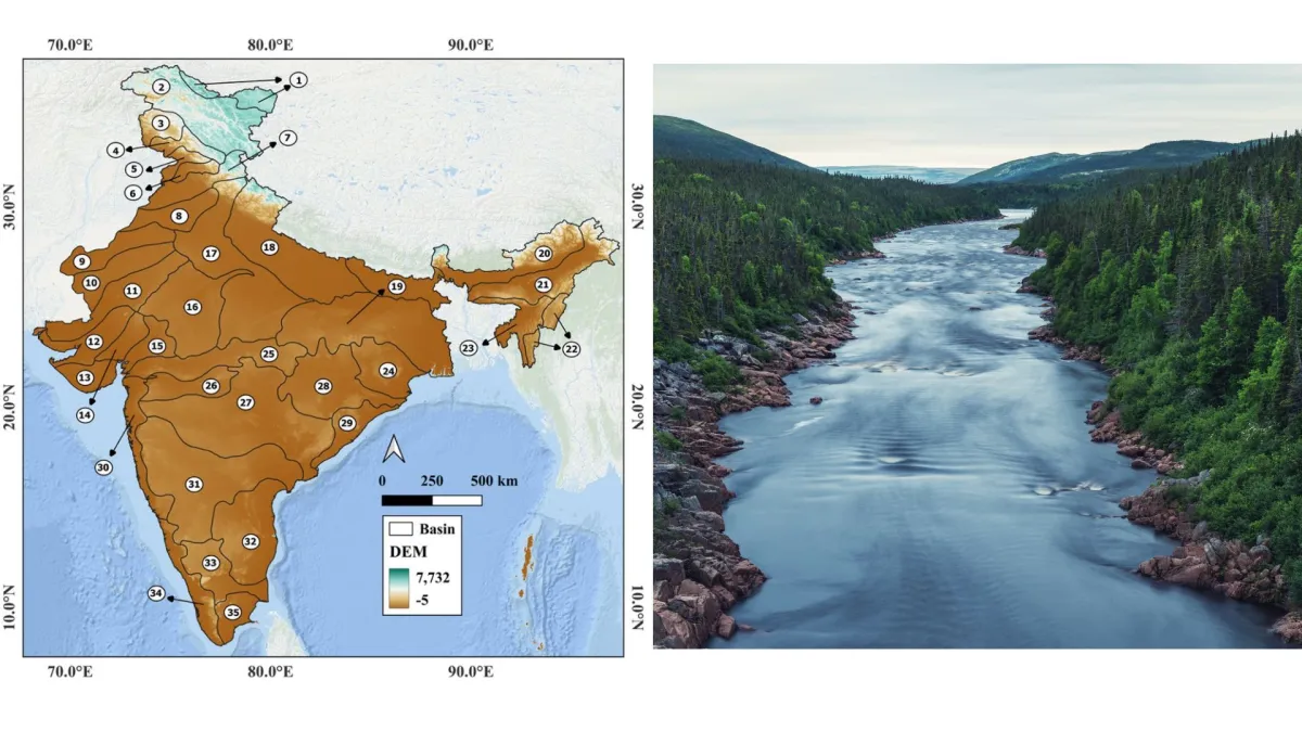
A landmark study warns that the National River Linking Project, designed to solve India’s water crisis, may inadvertently serve as a "superhighway" for invasive species, threatening to erase the unique biological identity of the subcontinent’s most precious freshwater ecosystems.
NEW DELHI — India’s ambitious blueprint to redraw its hydrological map is facing a new and formidable challenge. While the National River Linking Project (NRLP) has long been debated on the grounds of human displacement and forest submergence, a groundbreaking study has shifted the focus toward a silent, underwater threat: the mass migration of invasive alien species (IAS).
Researchers from the Ashoka Trust for Research in Ecology and the Environment (ATREE) and Yenepoya (Deemed to be University) have released findings suggesting that the proposed network of 15,000 kilometers of canals and 3,000 reservoirs could trigger an "explosion" of non-native species. These man-made arteries, designed to transport water from "surplus" to "deficit" basins, may inadvertently bypass ancient geographical barriers that have kept India’s river ecosystems distinct for millennia.
Main Facts: The Intersection of Engineering and Ecology
The National River Linking Project is one of the largest infrastructure undertakings in human history. Its primary goal is to mitigate the dual extremes of Indian weather—catastrophic flooding in the north and east, and chronic drought in the south and west. By connecting 37 rivers through 30 links, the project aims to irrigate 35 million hectares and generate 34,000 megawatts of hydroelectricity.
However, the ATREE-Yenepoya study reveals a significant "blind spot" in this developmental vision. The research indicates that the connectivity provided by these canals will allow 15 of the world’s most notorious invasive species to colonize previously isolated habitats. These include:

- Flora: Water hyacinth (Eichhornia crassipes) and Water lettuce (Pistia stratiotes), which choke sunlight and oxygen from water bodies.
- Fish: The African catfish (Clarias gariepinus), Common carp (Cyprinus carpio), and the Suckermouth catfish (Pterygoplichthys spp.), known for outcompeting native species for food and nesting sites.
- Others: The Red-eared slider turtle (Trachemys scripta elegans) and the Acute bladder snail (Physella acuta).
The study’s most alarming finding is that India’s primary biodiversity hotspots—including the Western Ghats and the Krishna and Godavari river basins—are also the most suitable environments for these invaders. In ecological terms, the areas we most need to protect are the ones most vulnerable to being overrun.
Chronology: From Colonial Vision to Modern Crisis
The concept of linking India’s rivers is not a modern invention, but its evolution has moved from colonial irrigation dreams to a massive 21st-century engineering mandate.
- 19th Century: Sir Arthur Cotton, a British irrigation engineer, first proposed linking major rivers like the Godavari and Krishna to facilitate inland navigation and combat famines.
- 1970s: Dr. K.L. Rao, a former Union Minister for Irrigation, proposed a "National Water Grid" to transfer water from the Ganga and Brahmaputra to the central and southern parts of India.
- 1980: The Ministry of Water Resources formulated the National Perspective Plan (NPP), which officially divided the project into the Himalayan and Peninsular components.
- 2002: The Supreme Court of India directed the Union Government to accelerate the project after a petition regarding the severe drought of that year. A high-level task force was subsequently formed.
- 2014–Present: The project received renewed political impetus. The Ken-Betwa Link Project (KBLP), the first major initiative under the NRLP, was greenlit, involving the diversion of water from the Ken River in Madhya Pradesh to the Betwa River in Uttar Pradesh.
- 2024–2026: As implementation begins on early phases, ecological researchers have begun utilizing advanced "species distribution modeling" to predict long-term biological consequences, leading to the current warnings regarding invasive species.
Supporting Data: Modeling the "Invasion Highways"
To reach their conclusions, the researchers employed a technique known as Species Distribution Modelling (SDM). This process involves mapping the current known locations of invasive species and correlating them with environmental variables such as temperature, rainfall, and water chemistry.
The Correlation Paradox
The study found a strong positive correlation between "native species richness" and "invasion suitability." Traditionally, ecologists hoped that healthy, biodiverse ecosystems would be resilient against invaders. However, the Indian context suggests the opposite: the very conditions that make the Western Ghats or the Godavari basin rich in endemic fish also make them a "paradise" for invasive species like the Mozambique tilapia.
Spatial Overlap
By overlaying suitability maps with the proposed 15,000km canal route, researchers identified specific "high-risk corridors." The canals act as "biotic bridges." For example, the African catfish, which is already present in several northern basins, would find a direct, man-made path into the pristine streams of the southern peninsula, where it has no natural predators.

The Decline of Freshwater Biodiversity
The study places these findings within a global context. Freshwater ecosystems cover less than 3% of the Earth’s surface but support 10% of all known species. Currently, freshwater species populations are declining at a rate three times faster than terrestrial or marine species. The NRLP, researchers argue, could accelerate this decline in India through "biotic homogenization"—a process where unique local species are replaced by a few widespread, aggressive "generalist" species.
Official Responses and the Development Debate
The findings have sparked a familiar tension between the Ministry of Jal Shakti (Water Resources) and environmental scientists.
The Government Stance
Proponents of the NRLP argue that the project is a "humanitarian necessity." Government officials often cite the "right to water" for millions of farmers in Vidarbha, Marathwada, and Rayalaseema. They contend that the socio-economic benefits of drought-proofing half the country outweigh the ecological risks, which they believe can be managed through "mitigation measures" such as fish screens and monitoring.
"Water is a national asset," a spokesperson for the National Water Development Agency (NWDA) has previously noted. "We cannot allow regions to perish in drought while billions of cubic meters of water flow unutilized into the sea."
The Scientific Rebuttal
However, the authors of the ATREE-Yenepoya study argue that the "surplus" water theory is ecologically flawed. They maintain that no river has "surplus" water; every drop reaching the sea performs critical functions, such as maintaining the salinity balance in estuaries and nourishing coastal fisheries.

Conservationists argue that the government’s Environmental Impact Assessments (EIAs) have historically focused on "charismatic megafauna" (like tigers in the Panna Tiger Reserve affected by the Ken-Betwa link) while almost entirely ignoring "micro-biodiversity" and the complex dynamics of invasive fish and mollusks.
Implications: Socio-Economic and Environmental Fallout
The "explosion" of invasive species is not merely a concern for naturalists; it carries dire consequences for India’s economy and food security.
1. Collapse of Inland Fisheries
Millions of Indians depend on inland fisheries for protein and livelihoods. Invasive species like the Common carp or Tilapia often breed faster and eat more aggressively than native Indian carps (Rohu, Katla, Mrigal). In many reservoirs where these invaders have been introduced, native fish populations have crashed, leading to a decline in the market value of the catch and the impoverishment of local fishing communities.
2. Water Quality and Infrastructure Damage
Species like the Water hyacinth can cover the entire surface of a reservoir within weeks. This blocks sunlight, leading to the death of underwater plants and the depletion of oxygen, which kills fish. Furthermore, invasive mollusks like the Acute bladder snail can clog irrigation pipes and hydroelectric cooling systems, leading to massive maintenance costs that were never factored into the NRLP’s original budget.
3. Evolutionary Loss
The river basins of India have been isolated for millions of years, allowing for the evolution of species found nowhere else on Earth. Connecting these basins is akin to "shaking a biological cocktail," according to the researchers. Once these unique genetic lineages are lost to homogenization, they cannot be recovered, regardless of how much money is spent on restoration.

4. Climate Change Vulnerability
As climate change makes rainfall more erratic, the study suggests that invasive species—which are generally more adaptable to extreme conditions—will have an even greater advantage over native species. By building the NRLP, India may be creating a water system that is more "connected" but less "resilient."
Conclusion: The Need for Ecological Foresight
The ATREE and Yenepoya study does not necessarily call for the total abandonment of water management, but it demands a radical shift in how such projects are planned. The researchers advocate for "ecological foresight"—the integration of invasion ecology into the very first stages of infrastructure design.
As India moves forward with the Ken-Betwa link and other phases of the NRLP, the "biological cost of connectivity" must be placed on the balance sheet alongside megawatts and hectares. Without such a shift, the quest to quench India’s thirst may end up poisoning the very lifeblood of its natural heritage. The challenge for the coming decade will be to ensure that in the process of linking its rivers, India does not inadvertently uncouple itself from its own ecological future.
