Introduction
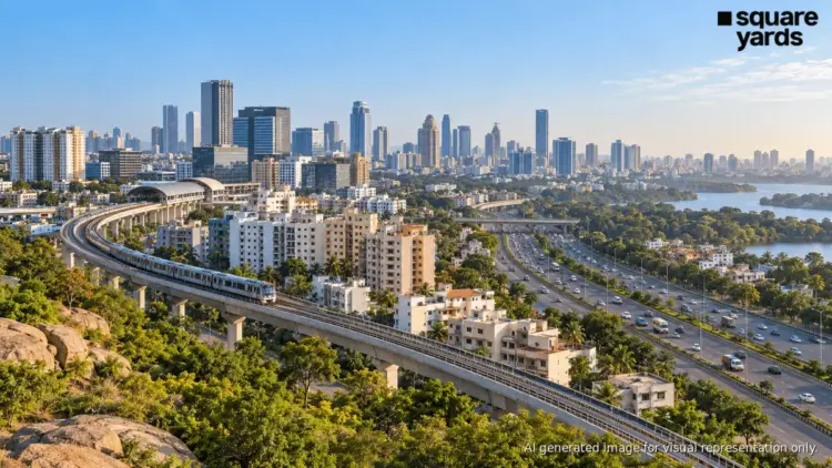
Karnataka has unveiled a transformative 10-year development blueprint for the Bengaluru Metropolitan Region (BMR), signaling a decisive move toward a polycentric urban model. As the traditional core of Bengaluru faces unprecedented pressure from rapid urbanization, the state government’s proposed strategy aims to decentralize growth by establishing nine integrated industrial townships and a massive housing inventory of over 6 lakh homes. Supported by a sophisticated multi-modal transport network—comprising Metro expansions, Regional Rapid Transit Systems (RRTS), and extensive ring roads—this plan represents one of the most ambitious infrastructure undertakings in the history of Southern India.
The vision, spearheaded by the BMR Economic Development Advisory Committee, seeks to redefine the relationship between employment hubs and residential corridors. By integrating industrial activity with affordable and worker-centric housing, the Karnataka government hopes to create a sustainable ecosystem that mitigates the "commute crisis" while opening new frontiers for real estate investment and industrial manufacturing.
I. Main Facts: The Pillars of the BMR Vision
The 10-year development plan is anchored by three primary pillars: industrial decentralization, mass housing provision, and high-speed regional connectivity.
1. The Integrated Industrial Townships
At the heart of the proposal is the creation of nine integrated industrial townships. These are not merely manufacturing zones but self-contained urban ecosystems. The government has already secured 7,900 acres of land for these projects, with an additional 5,600 acres currently in the process of acquisition. These townships are designed to move economic activity away from the saturated Central Business District (CBD) and the IT corridors of Whitefield and Electronic City.
2. The Housing Revolution
To support the workforce within these new industrial hubs, the plan proposes the development of 6 to 6.5 lakh new homes across the BMR. A significant portion of this—approximately 40,000 to 50,000 units—is specifically earmarked for industrial workers. This "work-where-you-live" philosophy is intended to reduce the burden on the city’s existing transportation infrastructure and ensure a stable labor supply for the manufacturing sector.
3. The Multi-Modal Transport Network
The plan outlines a staggering expansion of the region’s transit capabilities:
- Metro Expansion: A proposed 312-km addition to the Namma Metro network, aiming for completion or significant progress by 2037.
- Regional Rapid Transit System (RRTS): A 270-km high-speed rail network designed to connect Bengaluru with satellite growth centers like Tumakuru, Mysuru, and Kolar Gold Fields (KGF).
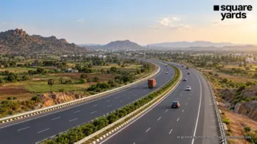
- Ring Road and Connectivity: A 210-km Ring Road that will integrate 10 additional hubs and bridge the gap between Phase II of the Peripheral Ring Road and the existing NICE Road.
- Suburban Rail: An additional 72 km of suburban rail connectivity to facilitate intra-regional movement.
II. Chronology: From Conception to Land Acquisition
The timeline of this ambitious plan reflects a sense of urgency in addressing Bengaluru’s growth bottlenecks.
- Initial Conceptualization (Pre-2024): Discussions regarding the "Greater Bengaluru" concept have circulated for years, but the need for a formalized, integrated 10-year plan became critical as traffic congestion and housing shortages reached a breaking point.
- October 5, 2024: Deputy Chief Minister and Bengaluru Development Minister D.K. Shivakumar chaired a pivotal meeting of the BMR Economic Development Advisory Committee. During this session, the broad strokes of the 10-year blueprint were officially outlined to stakeholders.
- Current Status (Late 2024): The state government is currently in the "Active Acquisition Phase." As of the latest reports, 7,900 acres have been successfully acquired. The notification and negotiation process for the remaining 5,600 acres is ongoing, targeting strategic corridors that align with the proposed transport routes.
- Projected Milestone (2037): The year 2037 has been set as the horizon for the completion of the major Metro expansions and the full operationalization of the integrated townships.
III. Supporting Data: Quantifying the Transformation
The scale of the BMR plan is best understood through the granular data points that define its infrastructure and utility requirements.
Transport Metrics
The proposed 312-km Metro expansion would more than triple the city’s current operational reach. When combined with the 270-km RRTS, the total rail-based high-speed connectivity for the region would exceed 600 km. This is designed to handle a projected daily ridership increase of nearly 45% by the mid-2030s.
Housing and Demographics
The 6.5 lakh housing units are expected to accommodate approximately 2.5 to 3 million people. By prioritizing 50,000 units for industrial workers, the government is addressing a critical gap in the "Affordable Housing" segment, which has seen dwindling supply in the core city areas due to skyrocketing land prices.
Utility and Sustainability: The Water Challenge
One of the most critical data points in the blueprint is the projected water demand. The BMR is expected to require 3,600 million liters per day (MLD) of water by 2037. To meet this, the plan includes:
- Expansion of the Cauvery Water Supply Scheme (Phase V and beyond).
- Integrated sewage treatment plants (STPs) designed for high-volume recycling.
- Massive investments in rainwater harvesting and groundwater recharge within the new townships to prevent the "Day Zero" scenarios that have threatened the city in recent years.
IV. Official Responses: The Government’s Strategic Intent
The Karnataka government, led by Deputy CM D.K. Shivakumar, has been vocal about the necessity of this plan. The official stance emphasizes that Bengaluru can no longer grow "inward" and must grow "outward" in a planned, structured manner.
D.K. Shivakumar, Deputy Chief Minister:
In his address to the advisory committee, Shivakumar noted that the primary goal is to ensure that "wealth and opportunity are distributed across the region, not just concentrated in a few square kilometers." He emphasized that the integration of the Peripheral Ring Road with the NICE Road is a "non-negotiable priority" to create a seamless circular flow of traffic around the city.
Department of Industries and Commerce:
Officials from the industries department have highlighted that the nine townships will be "sector-specific," potentially focusing on aerospace, semiconductors, and electric vehicle (EV) manufacturing. This specialization is intended to attract global Foreign Direct Investment (DDI) by providing ready-to-move-in ecosystems with dedicated housing.
Urban Planning Experts:
While the government is optimistic, urban planners have issued a cautionary response, noting that the "success of these proposals hinges entirely on the synchronization of the transport links with the township completion." There is a consensus that without the RRTS and Metro, these townships risk becoming "isolated concrete islands."
V. Implications: Real Estate, Economy, and the Future of Living
The implementation of the BMR 10-year plan will have far-reaching consequences for various sectors, most notably real estate and the regional economy.
1. The Shift in Real Estate Geography
For decades, property demand in Bengaluru was dictated by proximity to the "IT Belt." The new blueprint shifts the focus to satellite towns. Areas like Bidadi, Devanahalli, Nelamangala, Hoskote, Doddaballapur, and Magadi—previously considered peripheral or semi-rural—are now positioned as the next major residential and industrial hubs.
- Investor Sentiment: Real estate developers are likely to pivot toward these areas, focusing on large-scale township projects rather than standalone apartment complexes.
- Price Dynamics: While the core city prices may stabilize, these peripheral areas are expected to see a steady appreciation in land value as infrastructure milestones are met.
2. Economic Diversification
By creating integrated industrial zones, Karnataka is looking to diversify its economic portfolio. While IT remains the backbone, the focus on "industrial workers" suggests a massive push for manufacturing. This could transform the BMR into a global manufacturing hub, rivaling regions like Shenzhen or the industrial corridors of Vietnam.
3. Decongestion and Quality of Life
The most significant implication for the average citizen is the potential for decongestion. If 6 lakh people can live and work in satellite towns, the pressure on Bengaluru’s inner-city roads will diminish. The RRTS, in particular, could change the concept of "commuting," making it feasible for someone to live in Tumakuru or KGF while working in a Bengaluru-based industrial township.
4. Environmental and Civic Challenges
The scale of this expansion poses significant environmental risks. The conversion of nearly 13,500 acres of land into industrial and residential zones will require rigorous environmental oversight. The government’s ability to manage the 3,600 MLD water requirement and provide adequate sewage infrastructure will determine whether these new hubs become model cities or cautionary tales of urban sprawl.
Conclusion
The Karnataka government’s 10-year blueprint for the Bengaluru Metropolitan Region is a bold attempt to "future-proof" one of the world’s fastest-growing cities. By intertwining industrial growth with mass housing and high-speed transit, the plan moves away from reactive urban management toward proactive regional planning.
However, the road ahead is fraught with challenges. The successful execution of 312 km of Metro rail, the acquisition of thousands of acres of land, and the provision of massive water supplies by 2037 will require unprecedented inter-departmental coordination and sustained political will. If successful, this plan will not just expand Bengaluru; it will create a massive, interconnected economic engine that could define Karnataka’s prosperity for the next half-century. For residents and investors alike, the message is clear: the future of Bengaluru lies well beyond its current borders.