

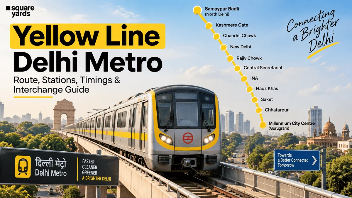
New Delhi — As of late 2026, the Delhi Metro Yellow Line (Line 2) remains the undisputed backbone of the National Capital Region’s (NCR) transit infrastructure. Spanning a massive 48.1-kilometer corridor that bisects the city from the northern outskirts to the high-rise corporate hubs of Gurugram, the Yellow Line is more than just a transit route; it is a socio-economic bridge connecting diverse worlds.
From the academic corridors of Delhi University to the historic markets of Old Delhi, the administrative heart of the Lutyens’ zone, and the "Cyber City" of Haryana, this line facilitates the daily movement of millions. This report provides an enriched, in-depth analysis of the Yellow Line’s operations, technical data, and its profound impact on the urban landscape of Delhi-NCR.
1. Main Facts: The Pulse of the North-South Corridor
The Yellow Line is a masterclass in multimodal urban planning. It serves as the primary north-south axis of the Delhi Metro Rail Corporation (DMRC) network. As of September 14, 2026, the line operates with high-frequency rolling stock, predominantly utilizing eight-coach trains to manage the immense passenger volume.
Key Operational Metrics:
- Terminals: Samaypur Badli (North Delhi) to Millennium City Centre Gurugram (formerly HUDA City Centre).
- Total Length: 48.1 Kilometers.
- Total Stations: 37 (a mix of 20 elevated and 17 underground stations).
- Color Code: Yellow.
- Average Daily Ridership: Estimated at over 1.2 million passengers in 2026.
- Interchanges: 8 major junctions connecting to Red, Blue, Pink, Violet, Magenta, and the Airport Express Line.
The line is unique because it transitions seamlessly between underground tunnels in the congested parts of Central and Old Delhi to elevated tracks in the residential and commercial suburbs. This architectural flexibility has allowed the DMRC to maintain speed and efficiency despite the city’s complex geography.
2. Chronology: The Evolution of Line 2
The journey of the Yellow Line is a reflection of Delhi’s rapid modernization over the last two decades.
- 2004–2005 (The Beginning): The first section opened between Vishwavidyalaya and Kashmere Gate, primarily serving the student population of North Campus.
- 2010 (The Gurugram Leap): A landmark year where the line was extended into Gurugram, Haryana. This transformed the commute for thousands of professionals who previously relied on the congested NH-48. The southern terminal was then known as HUDA City Centre.
- 2015 (The Northern Extension): The line reached its current northern terminus at Samaypur Badli, bringing the Outer Ring Road and Rohini sectors into the metro fold.
- 2023 (Rebranding): In a move to reflect the city’s evolving identity, the southern terminus was renamed "Millennium City Centre Gurugram," acknowledging the area’s status as a global corporate hub.
- 2024–2026 (Modernization Phase): Implementation of enhanced signaling (CBTC upgrades), improved last-mile connectivity through electric feeder buses, and the integration of digital ticketing via the "DMRC Momentum" app.
3. Supporting Data: Stations, Timings, and Fares
To navigate the Yellow Line effectively, commuters must understand the intricate network of stations and the logistical framework that keeps the trains running like clockwork.
Full Station List and Interchange Guide
The Yellow Line passes through some of the most strategic locations in the NCR. Below is the comprehensive 37-station list for 2026:
| # | Station Name | Area/Significance | Interchange Connection |
|---|---|---|---|
| 1 | Samaypur Badli | Outer Ring Road North | Northern Terminus |
| 2 | Rohini Sector 18-19 | Residential Hub | – |
| 3 | Haiderpur Badli Mor | North Delhi | Phase 4 Expansion |
| 4 | Jahangirpuri | Logistics/Residential | – |
| 5 | Adarsh Nagar | Local Market Hub | – |
| 6 | Azadpur | Asia’s Largest Fruit Market | Pink Line |
| 7 | Model Town | Upscale Residential | – |
| 8 | GTB Nagar | Student Hub (North Campus) | – |
| 9 | Vishwavidyalaya | Delhi University North Campus | – |
| 10 | Vidhan Sabha | Delhi Legislative Assembly | – |
| 11 | Civil Lines | Heritage/Administrative | – |
| 12 | Kashmere Gate | ISBT / Old Delhi | Red Line / Violet Line |
| 13 | Chandni Chowk | Old Delhi / Railway Stn | – |
| 14 | Chawri Bazar | Hardware Market / Heritage | – |
| 15 | New Delhi | NDLS Railway Station | Airport Express Line |
| 16 | Rajiv Chowk | Connaught Place (CBD) | Blue Line |
| 17 | Patel Chowk | Parliament/Museums | – |
| 18 | Central Secretariat | Government Offices | Violet Line |
| 19 | Udyog Bhawan | Ministries | – |
| 20 | Lok Kalyan Marg | PM’s Residence Area | – |
| 21 | Jor Bagh | Safdarjung Tomb/Lodhi Road | – |
| 22 | INA | Dilli Haat / Markets | Pink Line |
| 23 | AIIMS | Medical Research Hub | – |
| 24 | Green Park | South Delhi Residential | – |
| 25 | Hauz Khas | Village/Educational | Magenta Line |
| 26 | Malviya Nagar | Commercial/Select Citywalk | – |
| 27 | Saket | Residential/Courts | – |
| 28 | Qutab Minar | UNESCO World Heritage Site | – |
| 29 | Chhattarpur | Religious/Farmhouses | – |
| 30 | Sultanpur | Logistics/Design Hub | – |
| 31 | Ghitorni | Industrial/Residential | – |
| 32 | Arjan Garh | Delhi-Gurugram Border | – |
| 33 | Guru Dronacharya | Gurugram Entry | – |
| 34 | Sikandarpur | Corporate Hub | Rapid Metro Gurugram |
| 35 | MG Road | Mall Mile | – |
| 36 | IFFCO Chowk | Corporate Offices | – |
| 37 | Millennium City Centre | Southern Terminus | Gurugram Hub |
Fare Structure (2026)
DMRC continues to use a distance-based fare system. While prices are subject to periodic review, the 2026 structure prioritizes Smart Card users with a 10% discount to reduce congestion at token counters.
- 0–2 km: ₹10
- 2–5 km: ₹20
- 5–12 km: ₹30
- 12–21 km: ₹40
- 21–32 km: ₹50
- Above 32 km: ₹60
Note: Smart Card users also receive an additional 10% discount during off-peak hours (as per DMRC policy).
Journey Times (Approximate)
- Samaypur Badli to Rajiv Chowk: 50 minutes.
- New Delhi to Millennium City Centre: 35 minutes.
- Full Line Journey: 80 minutes.
4. Official Responses and Operational Standards
The DMRC has maintained that the Yellow Line is a priority for technological "retrofitting." According to official statements from the DMRC’s corporate communications department, several upgrades have been finalized by 2026:
Frequency and Capacity:
To tackle peak-hour rushes at Rajiv Chowk and Kashmere Gate, the DMRC has reduced headways (the time between two trains) to approximately 100-120 seconds during peak periods. This was achieved through the full implementation of the Communication-Based Train Control (CBTC) signaling system on portions of the line.
Safety and Sustainability:
"Our commitment to a green commute remains steadfast," a DMRC official noted in a recent 2026 briefing. "The Yellow Line now draws over 30% of its operational energy from solar power and utilizes regenerative braking systems to feed electricity back into the grid." Additionally, Platform Screen Doors (PSDs) have been integrated into the busiest underground stations (like Chandni Chowk and Rajiv Chowk) to prevent accidents and manage airflow.
Connectivity to the Airport:
The DMRC emphasizes the "Seamless Transfer" at New Delhi station. The interchange between the Yellow Line and the Airport Express Line has been optimized with walkalators and biometric-enabled entry for frequent flyers, allowing travelers from North Delhi to reach IGI Airport in under 60 minutes.
5. Implications: Urban, Social, and Economic Impact
The Yellow Line’s existence has fundamentally altered the geography of the NCR. Its implications are felt across three major sectors:
Real Estate and Urban Development
The "Metro Effect" is most visible along the Yellow Line. Property values in North Delhi (Rohini, Adarsh Nagar) and South Delhi (Saket, Hauz Khas) have seen sustained growth due to metro proximity. In Gurugram, the areas around MG Road and Millennium City Centre have become the most sought-after commercial real estate in India, housing Fortune 500 companies. Transit-Oriented Development (TOD) policies have encouraged high-density residential complexes within a 500-meter radius of these stations.
Socio-Economic Mobility
The line serves as a social leveler. It connects the "University Belt" (Vishwavidyalaya) with the "Job Belt" (Gurugram). Students from middle-income neighborhoods in North Delhi can access premium education and internships in South and Central Delhi without the burden of expensive private transport. Similarly, the line provides affordable access to specialized healthcare at AIIMS and Safdarjung Hospital for residents across the NCR.
Environmental Footprint
By 2026, the Yellow Line is estimated to have removed over 200,000 private vehicles from the road daily. This reduction in vehicular emission is critical for a city like Delhi, which battles severe air pollution during winter months. The metro remains the city’s most effective tool in its "Green Action Plan."
Conclusion: The Future of the Yellow Line
As we look toward the 2030s, the Delhi Metro Yellow Line continues to evolve. With the proposed Phase 4 expansions and further integration with the Regional Rapid Transit System (RRTS), the line’s role as a feeder and a primary carrier will only intensify.
For the commuter, the Yellow Line is not just a train; it is the certainty of reaching work on time, the ease of visiting a heritage site, and the comfort of a climate-controlled environment in the heat of a Delhi summer. It remains, quite literally, the golden thread that sews the fabric of the National Capital together.
