

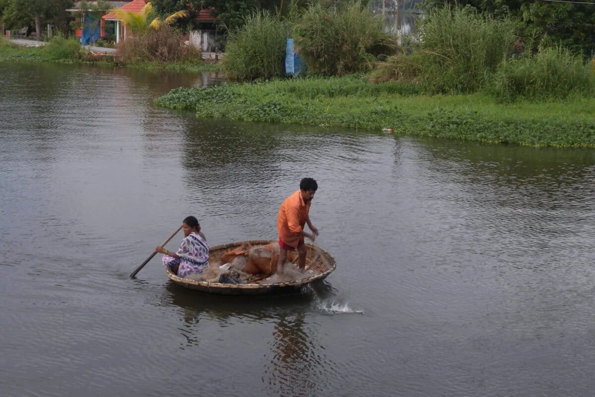
ALAPPUZHA, KERALA – In the emerald landscape of southern India lies Kuttanad, a geographical marvel where land and water exist in a state of perpetual, negotiated embrace. Known globally as the "Rice Bowl of Kerala," this region is one of the few places on Earth where farming is practiced successfully nearly two meters below sea level. Yet, beneath its postcard-perfect exterior of swaying palms and labyrinthine canals lies an ecosystem on the brink of collapse.
Once a thriving estuarine system governed by the rhythmic pulse of the monsoons and the tides of the Arabian Sea, Kuttanad has been transformed by decades of aggressive engineering and short-sighted state policies. Today, the region faces a triad of existential threats: catastrophic flooding, toxic pollution, and the invasive "green menace" of water hyacinth. As climate change accelerates sea-level rise, the very interventions designed to protect this agricultural heritage may now be the primary drivers of its destruction.
The Main Facts: A Global Heritage Under Siege
Kuttanad is not merely a farm; it is a "Globally Important Agricultural Heritage System" (GIAHS), a prestigious designation granted by the Food and Agriculture Organization (FAO) of the United Nations. It shares this status with iconic landscapes like the terraced rice fields of the Philippines and the saffron fields of Kashmir.
The region spans approximately 1,100 square kilometers, including 524 sq km of low-lying polders (reclaimed rice fields) and a vast network of water bodies connected to the Vembanad Lake—the longest lake in India and a Ramsar site of international importance.
![A fertile landscape at the crossroads of ecology and development [Commentary]](https://imgs.mongabay.com/wp-content/uploads/sites/30/2026/08/03125249/4670487709_c95df8f47d_4k-scaled-e1785742237892-1200x800.jpg)
The core of Kuttanad’s uniqueness lies in its geological youth. Formed by the accumulation of silt from three major rivers—the Pampa, Achankovil, and Manimala—the delta was historically a brackish-water paradise. It functioned as a massive nursery for marine and estuarine life, including the prized karimeen (pearl spot) and various prawn species. However, human ambition in the mid-20th century sought to "tame" this wild hydrology to ensure India’s food security, setting off a chain reaction of ecological degradation that continues to this day.
Chronology of Intervention: From Reclamation to Regulation
The transformation of Kuttanad began in earnest during the mid-20th century, driven by the "Grow More Food" campaign following India’s independence.
The Era of Reclamation (1940s–1960s)
To maximize rice production, the state encouraged the conversion of shallow portions of Vembanad Lake into rice paddies. Farmers constructed massive embankments (bunds) and pumped out water to create padasekharams (polders). This reclamation was a feat of traditional engineering, but it came at a staggering cost: the surface area of Vembanad Lake was reduced by an estimated 65%. This loss fundamentally diminished the lake’s capacity to act as a natural sponge, or "shock absorber," for monsoon floods.
The Thottapally Spillway (1955)
As reclamation reduced the lake’s volume, the risk of flooding increased. In 1955, the government constructed the Thottapally Spillway, designed to drain excess floodwater directly into the Arabian Sea. While envisioned as a safety valve, the spillway’s performance has been historically inconsistent, often failing to handle the sheer volume of water delivered by intensifying monsoon cycles.
![A fertile landscape at the crossroads of ecology and development [Commentary]](https://imgs.mongabay.com/wp-content/uploads/sites/30/2026/08/03131024/FARMERS_ENGAGED_IN_RICE_CULTIVATION_KUTTANAD-768x512.jpg)
The Thanneermukkom Saltwater Regulator (1974)
The most consequential intervention was the construction of the Thanneermukkom Saltwater Regulator. This massive barrage was built to block the intrusion of saline water from the sea during the summer months. The goal was to allow farmers to grow a second crop of rice (the kumbha season) by maintaining a freshwater environment year-round. While it achieved its agricultural goal, it effectively split the Vembanad Lake into two distinct zones, killing the natural estuarine cycle and trapping pollutants in a stagnant freshwater pool.
Supporting Data: The Cost of Stagnation
The ecological fallout of these engineering projects is now being quantified by scientists and environmentalists.
The Microplastic Crisis
Recent studies have revealed a harrowing level of contamination in the Vembanad estuary. Sediments on the lake bed contain microplastics (particles smaller than 5 mm) at concentrations ranging from 96 to nearly 500 particles per square meter. The water column is saturated with low-density polyethylene (LDPE), polypropylene, and nylon, much of it originating from discarded fishing nets and domestic waste.
This is not just an environmental issue; it is a public health crisis. The native black clam, a staple for thousands of local families, is a bottom-dweller that frequently ingests these plastics. Through bioaccumulation, these toxins enter the human food chain, posing long-term health risks to the local population.
![A fertile landscape at the crossroads of ecology and development [Commentary]](https://imgs.mongabay.com/wp-content/uploads/sites/30/2026/08/03134717/IMG_0598-768x512.jpg)
The "Green Menace"
The Thanneermukkom Regulator created the perfect conditions for the invasive water hyacinth (Eichhornia crassipes). Without the natural "cleansing" effect of seasonal salt water, this weed has proliferated, forming thick mats that block sunlight and deplete dissolved oxygen. This has created "dead zones" where aquatic life cannot survive, while simultaneously obstructing navigation and providing a breeding ground for disease-carrying mosquitoes.
Siltation and Erosion
Simultaneously, the intensification of plantation agriculture (tea, rubber, and coffee) in the Western Ghats has led to massive deforestation. The resulting soil erosion has increased the silt load of the rivers entering Kuttanad. Instead of replenishing the delta, this silt is clogging the already narrowed channels of the Vembanad Lake, further exacerbating the flood risk.
Official Responses: The Ghost of the Swaminathan Report
The most significant attempt to address Kuttanad’s decline came in 2007, when the state government commissioned the late Dr. M.S. Swaminathan, the father of India’s Green Revolution, to study the region.
The resulting report, titled "Measures to Mitigate Agrarian Distress in Alappuzha and Kuttanad Wetland Ecosystem," was a comprehensive blueprint for restoration. Key recommendations included:
![A fertile landscape at the crossroads of ecology and development [Commentary]](https://imgs.mongabay.com/wp-content/uploads/sites/30/2026/08/03140152/Thanneermukkom_Bund-768x512.jpg)
- Declaring Kuttanad a Special Agricultural Zone (SAZ) to protect farmland.
- Halting all further reclamation of backwaters and canals.
- Modernizing the Thottapally Spillway and Thanneermukkom Regulator to allow for better water flow.
- Promoting integrated farming systems, such as rice-fish cultivation, to reduce reliance on chemical fertilizers.
In 2008, the Union Cabinet approved the ₹1,840-crore Kuttanad Package based on these recommendations. However, over a decade later, the package is widely regarded as a failure. Local activists and experts point to poor coordination between state and central agencies, a lack of political will, and a focus on "civil works" (concrete construction) rather than ecological restoration.
Implications: A Paradigm Shift or a Slow Death?
Kuttanad now stands at a crossroads. The catastrophic floods of 2018, which brought Kerala to a standstill, served as a final warning that the region’s current flood management infrastructure is no match for climate change.
The Case for Decommissioning
An increasing number of ecologists are now calling for a radical rethink: the decommissioning of the Thanneermukkom Regulator and the Thottapally Spillway. While politically difficult, allowing the natural tidal and fluvial regimes to re-establish would restore the brackish nature of the estuary. This would naturally control the water hyacinth population, revive the estuarine fish stocks, and potentially re-naturalize the flood cycles.
Turning Waste into Value
There is also an economic opportunity in the current crisis. Instead of viewing water hyacinth as mere waste, community-led initiatives are exploring its use for handcrafted paper, fiberboard, and biogas. Employing the traditional kadapuram (fishing communities) to harvest the weed could provide local employment while cleaning the waterways.
![A fertile landscape at the crossroads of ecology and development [Commentary]](https://imgs.mongabay.com/wp-content/uploads/sites/30/2026/08/03141008/4474670009_1a2d6ac01c_5k-768x512.jpg)
The Threat of Mass Tourism
Further complicating the recovery is the surge in mass tourism. Houseboats and luxury resorts, while providing revenue, often discharge untreated sewage directly into the fragile wetlands. Without strict regulation, tourism threatens to be the "final blow" to an already stressed ecosystem.
Conclusion: A Parable of Human Ambition
The story of Kuttanad is a poignant parable of human ambition clashing with ecological limits. The very engineering "marvels" that secured food for a hungry nation in the 1970s have become the shackles preventing the region’s survival in the 2020s.
The path forward requires a shift from a mindset of "controlling" nature to one of "living with" it. For the "Rice Bowl of Kerala" to survive for future generations, the barriers—both literal and metaphorical—between the hills, the rivers, and the sea must be dismantled. Only then can Kuttanad regain its resilience and continue to be the emerald heart of Kerala.
About the Author: The contributor is an adjunct professor at the National Institute of Advanced Studies, Bengaluru, specializing in wetland ecosystems and climate resilience.
