New research reveals a stark divergence in fire regimes between the Eastern and Western Ghats, challenging traditional conservation models and highlighting the complex interplay of climate change and human activity.
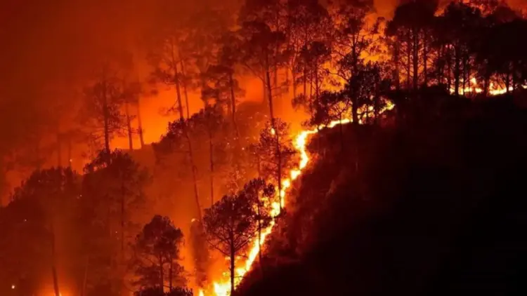
A comprehensive study spanning twenty years of satellite data has uncovered a dramatic shift in how fire behaves across India’s most vital wildlife sanctuaries. While the Eastern Ghats are experiencing a rapid and dangerous intensification of wildfire activity, the Western Ghats have seen a significant decline in burned areas. This "fire paradox" is forcing ecologists and policymakers to rethink the future of forest management in the subcontinent.
The research, conducted by the Centre for Wildlife Studies (CWS) and published in Ecosphere, evaluated approximately 20,000 square kilometers of protected forest land across 13 flagship reserves. The findings provide a granular look at how regional climate patterns, local human population densities, and varying vegetation types create vastly different fire "personalities" even within the same country.
Main Facts: A Tale of Two Mountain Ranges
The core of the study lies in the contrasting trajectories of India’s two primary mountain ranges. Between 2002 and 2022, the Eastern Ghats—a discontinuous range of mountains along India’s eastern coast—emerged as a major hotspot for fire activity. According to the data, the annual burned area in this region rose at a staggering rate of 9.3% per year.
Conversely, the Western Ghats—a UNESCO World Heritage site and global biodiversity hotspot—witnessed a 10.8% annual decline in burned areas over the same period. Central India, often characterized by its expansive teak and sal forests, occupied a middle ground, showing more stability but still facing significant seasonal pressures.
The researchers identified three primary drivers that dictate these trends:
- Vegetation Composition: The fire-prone dry deciduous forests of the Eastern Ghats versus the moisture-heavy evergreen and semi-evergreen forests of the Western Ghats.
- Climate Variability: The increasing frequency of droughts in some regions versus localized increases in rainfall or humidity in others.
- Human Ignition: The use of fire by local communities for non-timber forest product (NTFP) collection, grazing, and agricultural clearing.
The study emphasizes that fire is not a monolithic threat; rather, it is a localized phenomenon where human and climate factors explain between 21% and 77% of fire activity depending on the specific reserve.
Chronology: Two Decades of Satellite Surveillance (2002–2022)
The study utilizes a twenty-year timeline to move beyond seasonal fluctuations and identify long-term ecological shifts. By using NASA’s MODIS (Moderate Resolution Imaging Spectroradiometer) sensor data, researchers were able to track "burned area" signatures with high precision across two decades.
- 2002–2010: The Baseline Period. During the first decade of the millennium, fire regimes in the Eastern Ghats were frequent but relatively consistent with historical norms. In the Western Ghats, high-profile fires were occasional but often linked to specific El Niño events.
- 2011–2018: The Divergence. A noticeable split began to emerge mid-study. As global temperatures rose, the Eastern Ghats began to experience more frequent and prolonged "fire seasons." Meanwhile, a combination of intensified forest management and changing precipitation patterns in the Western Ghats began to suppress the total area burned.
- 2019–2022: The Intensification. The final years of the study recorded the sharpest increases in the Eastern Ghats. This period was marked by several high-intensity fire years that have begun to fundamentally alter the forest structure, promoting the growth of fire-hardy species over native timber.
The chronology suggests that the "fire-return interval"—the average time between successive fires in the same location—has shrunk dangerously in the East. In the Eastern Ghats, the interval is now just 14 years. In contrast, the Western Ghats boast a fire-return interval of 92 years, while Central India stands at 31 years.
Supporting Data: The Statistics of a Burning Landscape
The scale of the study is immense, covering 13 wildlife reserves that represent the backbone of India’s conservation efforts. The data reveals that the relationship between human density and fire is not linear, but rather "paradoxical."
The Human Paradox
One of the most striking findings involves the correlation between human population density and fire frequency.

- Positive Correlation: In the Kawal Wildlife Sanctuary (Telangana) and the Nagarjunasagar-Srisailam Tiger Reserve (Andhra Pradesh), higher human population density was strongly associated with more frequent fires. Here, human activity—likely related to land clearing and resource extraction—is a primary ignition source.
- Negative Correlation: In Nagarahole and Bandipur National Parks (Karnataka), the study found the opposite. Despite high human pressure on the fringes, these areas saw fewer fires. Researchers attribute this to more intensive forest management, better-funded rapid response teams, and perhaps a shift in local land-use practices that prioritize fire prevention to protect valuable timber and tourism assets.
Regional Breakdown of Burned Area Trends
| Region | Annual Change in Burned Area | Fire-Return Interval (Years) |
|---|---|---|
| Eastern Ghats | +9.3% (Increase) | 14 |
| Central India | Stable/Moderate | 31 |
| Western Ghats | -10.8% (Decrease) | 92 |
The study notes that in the Western Ghats, "local factors, including wetter conditions and changing land use, may be offsetting drought- or human-driven fire pressure." This suggests that even as the planet warms, local ecological resilience and management can play a decisive role in fire outcomes.
Official Responses and Expert Insights
Lead author Narendran Kodandapani emphasizes that the ubiquity of wildfires across India masks a complex internal reality.
"Wildfires are ubiquitous across various eco-regions of India. However, each region is characterized by variation in trends, drivers, and ecological challenges," Kodandapani stated. He argues that the current "one-size-fits-all" approach to fire management—which often focuses solely on total suppression—is inadequate.
The research team from the Centre for Wildlife Studies suggests that "Integrated Fire Management" (IFM) is the only path forward. IFM involves:
- Community Engagement: Recognizing that fire is often a tool for local livelihoods and working with communities to manage ignitions rather than criminalizing them.
- Climate Integration: Using real-time meteorological data to predict high-risk years and deploying resources proactively.
- Vegetation Sensitivity: Acknowledging that some ecosystems need fire, while others are destroyed by it.
The study’s authors point out that the "paradoxical trend" in India—where some areas burn more and others less—is driven by a cocktail of forest management, land-use change, anthropogenic climate change, and natural climate variability.
Implications: The Ecological Cost of Too Much (and Too Little) Fire
The findings carry heavy implications for biodiversity and the survival of iconic Indian species like the Bengal tiger, Indian elephant, and various endemic flora.
The Eastern Ghats: The "Grassification" Trap
In the Eastern Ghats, the 9.3% annual increase in fire is triggering a process ecologists call "grassification." Frequent fires kill off native tree saplings before they can reach maturity. In their place, fire-resistant grasses like Cymbopogon (lemon grass) thrive.
- The Risk: These grasses provide high fuel loads for the next year’s fire, creating a feedback loop.
- The Result: A transition from diverse, carbon-sequestering forests to degraded scrublands and grasslands that cannot support the same level of biodiversity.
The Western Ghats: The Encroachment Threat
Counter-intuitively, the decline in fire in certain parts of the Western Ghats also presents a risk. Some ecosystems, particularly high-altitude shola-grasslands, evolved with a specific relationship to fire.
- The Risk: Without occasional, low-intensity fires, woody plants and invasive species can encroach upon open grasslands.
- The Result: These grasslands are essential grazing grounds for herbivores like the Gaur and the Nilgiri Tahr. If the grasslands disappear, the entire food chain—up to the apex predators—is threatened.
A Call for Nuanced Policy
The study concludes that Indian fire policy must move away from a "firefighting" mentality toward a "fire management" philosophy. The researchers argue that a region-specific deconstruction of forest fires is essential. For instance, the strategies used in the moisture-laden hills of Kerala (Western Ghats) cannot be the same as those used in the dry, fragmented forests of Andhra Pradesh (Eastern Ghats).
As climate change continues to alter rainfall patterns and temperature regimes, the "Great Divide" in India’s fire landscape is likely to widen. The CWS study serves as a critical warning: without a sophisticated, data-driven approach to fire, India’s most cherished wildlife reserves may either go up in smoke or be fundamentally altered by the lack of it.