

JODHPUR — In an era where the "digital twin" of our planet is becoming a necessity for survival rather than a luxury for planners, the accuracy of global datasets has never been more critical. A landmark study conducted by researchers from the Indian Space Research Organisation’s (ISRO) National Remote Sensing Centre (NRSC) has provided a rigorous "stress test" of the GlobalBuildingAtlas (GBA), the world’s most ambitious open-access 3D digital map.
While the study lauds the GBA’s near-perfect ability to identify building footprints on a horizontal plane, it exposes a staggering "vertical deficit." The research reveals that the AI-driven model consistently underestimates the height of structures in rapidly urbanizing Indian metropolises, sometimes shrinking skyscrapers by more than 50%. This discrepancy poses significant risks for climate modeling, disaster management, and urban infrastructure development in the Global South.
Main Facts: A Tale of Two Dimensions
The GlobalBuildingAtlas (GBA) was released as a revolutionary tool, offering a three-dimensional inventory of approximately 2.75 billion buildings worldwide. It was designed to provide not just the outlines of structures (footprints) but also their estimated heights and simplified 3D shapes. However, the NRSC study, focusing on the complex urban fabrics of Mumbai, Bengaluru, Hyderabad, and Kolkata, found a stark contrast between horizontal and vertical reliability.
Key Findings Include:

- Horizontal Precision: In planned residential areas across five major Indian cities, the GBA achieved a completeness ratio exceeding 99%. In cities like Bengaluru, the digital map was almost indistinguishable from ground-truth data regarding building locations.
- Vertical Inaccuracy: The dataset exhibited a systematic negative bias in height estimation. For instance, a 266-meter skyscraper in Mumbai was recorded as a mere 113 meters in the GBA—a 153-meter error.
- The "Height Gap": Errors for mid-rise buildings frequently exceeded 40%, with the AI struggling to interpret the dense, multi-layered architecture typical of Indian urban centers.
- Technological Limitation: The GBA relies on monocular optical imagery (2D photos) and AI interpretation rather than direct 3D measurement tools like Lidar, leading to confusion caused by shadows, tree canopies, and complex roof structures.
Chronology: From Open-Access Ambition to Scientific Scrutiny
The journey of the GlobalBuildingAtlas began with the objective of filling a massive data gap in global urbanism. Historically, high-quality 3D building data was the exclusive domain of wealthy nations or private corporations. The GBA sought to democratize this data by using AI to process massive volumes of satellite imagery.
The Timeline of Evaluation:
- GBA Release: The dataset was made public, offering the first-of-its-kind global 3D perspective at a "Level of Detail 1" (LOD1), which represents buildings as flat-topped blocks.
- The ISRO Initiative: Recognizing the importance of this data for India’s "Smart Cities Mission," researchers at the NRSC initiated an independent validation study. They sought to determine if a model likely trained on Western architectural styles could accurately reflect the "verticality" of Indian cities.
- The Stress Test (2024-2026): The team selected 20 representative structures across diverse urban environments—from the sprawling industrial warehouses of Hyderabad to the soaring residential towers of Mumbai’s skyline.
- Publication of Findings: The results, released in August 2026, serve as a critical advisory for the global scientific community, highlighting the "Global South gap" in AI training models.
Supporting Data: Methodology and Metrics
To challenge the GBA’s estimates, the NRSC team employed a sophisticated "yardstick from space": NASA’s ICESat-2 (Ice, Cloud, and land Elevation Satellite-2).
The ICESat-2 Benchmark
Unlike the GBA, which uses 2D photos to "guess" height, ICESat-2 utilizes the Advanced Topographic Laser Altimeter System (ATLAS). This instrument fires trillions of laser photons at the Earth’s surface and measures the travel time of returning photons with centimeter-level precision. This provided the researchers with an indisputable "ground truth" for building heights.
Horizontal Validation via Bhuvan and AI
For horizontal accuracy, the researchers utilized ISRO’s own Bhuvan portal, a high-resolution remote sensing platform. They processed these images using the Segment Anything Model 2 (SAM 2), a cutting-edge AI model that allows for precise segmentation of objects within an image. This ensured that the "footprint" comparison was based on the most accurate visual data available in India.

Comparative Metrics
The study highlighted a "negative bias" that scaled with building height.
- Low-Rise Structures: Generally more accurate, though often confused by surrounding vegetation.
- Mid-Rise (10-20 stories): Average error rates of 30-40%.
- High-Rise (>50 stories): The most significant failures. The AI’s inability to account for the perspective distortion in 2D satellite photos resulted in skyscrapers being "compressed" in the digital model.
Official Responses and Technical Analysis: Why the AI Failed
While the creators of the GlobalBuildingAtlas have not yet issued a formal update, the NRSC researchers provided a comprehensive technical post-mortem on why the model struggled with Indian topography.
1. Training Data Bias
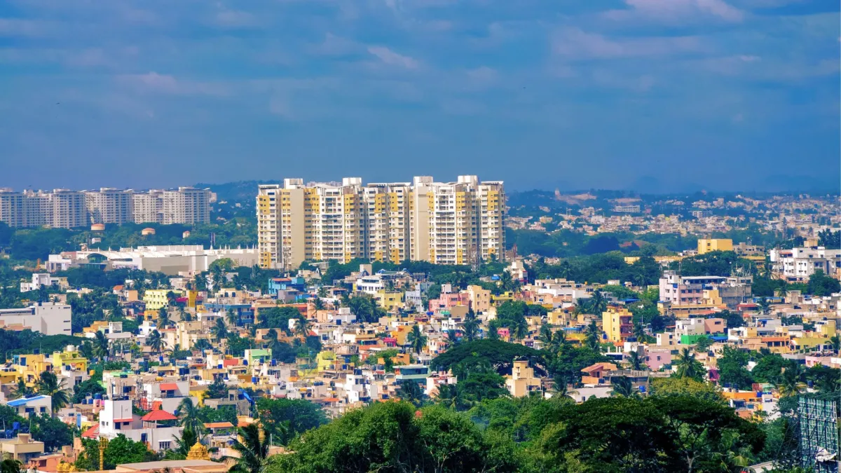
The AI models underpinning the GBA were predominantly trained on datasets from Europe and North America. In these regions, urban layouts are often more standardized, and building heights are more uniform within specific zones. In contrast, Indian cities feature "hyper-density," where a 40-story luxury tower might stand immediately adjacent to low-rise settlements or dense tree cover. The AI, unaccustomed to such contrast, fails to differentiate the shadows and perspectives correctly.
2. The Monocular Limitation
The GBA uses monocular imagery, which is essentially a single-lens view. To calculate height, the AI must look at the angle of shadows and the "lean" of the building in the photo. In the dense urban canyons of Mumbai or Kolkata, shadows often overlap, and the "lean" of one building may be obscured by another, leading the AI to produce a conservative, lower-height estimate.
3. Level of Detail (LOD) Constraints
The GBA operates at LOD1, which treats every building as a simple extruded polygon with a flat roof. Indian architecture, however, is characterized by complex roofscapes, including water tanks, lift machine rooms, helipads, and decorative spires. These "extra" vertical elements are often discarded or miscalculated by the simplified LOD1 model.

Implications: The Real-World Risks of "Shrunken" Cities
The NRSC study is more than a technical critique; it is a vital warning for various sectors that rely on 3D urban data.
Disaster Management and Flood Modeling
In cities like Mumbai and Bengaluru, which are prone to heavy monsoon flooding, 3D models are used to predict how water will flow through streets and which floors of buildings will remain safe. If a building is modeled as being 50% shorter than it actually is, flood-risk assessments could be dangerously inaccurate, leading to flawed evacuation plans and inadequate resource allocation.
Solar Energy Potential
As India pushes toward its ambitious renewable energy targets, the GBA is a primary tool for calculating the "solar rooftop potential" of cities. Height accuracy is crucial here; taller neighboring buildings cast shadows that significantly reduce the efficiency of solar panels on shorter roofs. Underestimating heights leads to an overestimation of solar viability, potentially resulting in failed green energy investments.
Urban Heat Islands and Climate Science
Climate scientists use 3D city models to study the "Urban Heat Island" effect, where buildings trap heat. The "canyon effect"—how heat is trapped between tall buildings—depends entirely on the height-to-width ratio of streets. Inaccurate height data means climate models will underestimate how hot Indian cities will become, hindering the development of effective cooling strategies.
The Path Forward: Integrating Lidar and Local Data
The ISRO team concludes that while the GlobalBuildingAtlas is a "goldmine" for horizontal urban planning and population density studies, it cannot yet be trusted for vertical applications in the Global South.

The researchers suggest a hybrid approach for the future: integrating AI-driven footprints with localized laser data from satellites like ICESat-2 or indigenous Indian Lidar missions. By "teaching" AI models to recognize the unique architectural and density patterns of Indian cities, developers can move toward a digital world that is as tall, complex, and vibrant as the real one.
As India continues its trajectory toward becoming a predominantly urban nation, the accuracy of its digital mirrors will determine the safety, sustainability, and resilience of its future cities.
