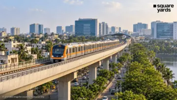
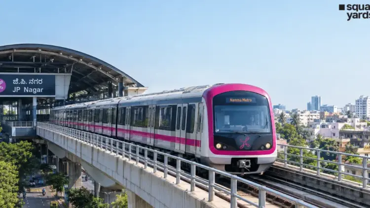
BENGALURU – In a significant stride toward alleviating the chronic traffic congestion of South Bengaluru, the Bangalore Metro Rail Corporation Limited (BMRCL) has achieved a pivotal milestone for the Reach-6 line, popularly known as the Pink Line. The 7.5-kilometer elevated section of the corridor, stretching from Kalena Agrahara to Tavarekere, has officially received safety clearance following a series of rigorous statutory inspections and technical evaluations.
This clearance paves the way for the eventual operationalization of a crucial segment of the 21.25-km Pink Line, which is designed to provide a seamless north-south link through the heart of the city. As Bengaluru continues to grapple with infrastructure challenges, the progress on the Pink Line represents a beacon of hope for thousands of daily commuters along the high-density Bannerghatta Road corridor.
1. Main Facts: The Elevated Milestone and Route Overview
The Pink Line is a cornerstone of Namma Metro’s Phase 2 expansion. Unlike the existing Purple and Green lines, the Pink Line is unique for its extensive underground stretch combined with a strategic elevated southern section.
The Elevated Section
The recently cleared 7.5-km elevated stretch comprises six key stations:
- Kalena Agrahara (formerly Gottigere)
- Hulimavu
- IIM Bangalore
- JP Nagar 4th Phase
- Jayadeva Hospital
- Tavarekere
This section runs primarily along Bannerghatta Road, an arterial route that serves as a lifeline for southern residential hubs and major institutional landmarks. The safety clearance signifies that the civil structures, track work, and signaling systems on this stretch meet the stringent standards required for passenger safety.
The Full Corridor
Once completed, the 21.25-km Pink Line will connect Kalena Agrahara in the south to Nagawara in the north. The route is divided into:
- Elevated Section: 7.5 km (South)
- Underground Section: 13.76 km (Central and North)
- Total Stations: 18 (6 elevated, 12 underground)
2. Project Chronology: From Blueprint to Reality
The journey of the Pink Line has been one of technical complexity and strategic planning.
- Phase 2 Approval: The Pink Line was conceptualized as part of Namma Metro Phase 2 to address the gaps in the north-south connectivity that the Green Line could not fully cover.
- Construction Commencement: Work on the elevated section began in the late 2010s, facing the dual challenges of heavy traffic management on Bannerghatta Road and land acquisition.
- The Underground Challenge: While the elevated section moved steadily, the underground portion (Dairy Circle to Nagawara) faced significant hurdles. Tunneling through Bengaluru’s erratic geology—ranging from hard granite to soft soil—required the deployment of multiple Tunnel Boring Machines (TBMs).
- Current Status (2024-2025): The elevated section has completed its civil and technical trials. The safety clearance recently obtained is the final statutory hurdle before the BMRCL can invite the Commissioner of Metro Railway Safety (CMRS) for the final inspection.
- Future Timeline: While the southern elevated section is nearing readiness, the underground stretch is still under construction. BMRCL expects to begin trials for the underground segment by late 2026, with full-line operations likely to follow shortly thereafter.
3. Supporting Data: Technical Specifications and Network Role
To understand the scale of the Pink Line, it is essential to look at the technical data and its integration into the wider Namma Metro ecosystem.
Project Feature Table
| Project Feature | Details |
|---|---|
| Total Corridor Length | 21.25 km |
| Route | Kalena Agrahara (South) to Nagawara (North) |
| Elevated Section | 7.5 km (Kalena Agrahara to Tavarekere) |
| Underground Section | 13.76 km (Dairy Circle to Nagawara) |
| Number of Stations | 18 (6 Elevated, 12 Underground) |
| Key Interchanges | Jayadeva Hospital, MG Road, Nagawara |
| Primary Network Role | Connecting South residential hubs with the CBD and North growth corridors |
Strategic Interchanges
The Pink Line is not an isolated route; it is designed to be a "connector" line. Its success hinges on four major interchange points:
- Jayadeva Hospital: A massive multi-level interchange connecting the Pink Line with the Yellow Line (RV Road to Bommasandra/Electronic City).
- MG Road: Connecting with the operational Purple Line, allowing passengers from the south to reach the eastern IT corridor (Whitefield) or western suburbs.
- Nagawara: A future interchange with the Blue Line (Central Silk Board to Kempegowda International Airport), facilitating easy airport access for central and southern residents.
- JP Nagar 4th Phase: Planned to connect with the proposed Orange Line under Metro Phase 3.
4. Official Responses and Operational Outlook
BMRCL officials have emphasized that the safety clearance of the elevated section is a testament to the engineering precision maintained despite the constraints of working in a congested urban environment.
"The Pink Line represents a new era of connectivity for Bengaluru," a senior BMRCL official noted during a recent technical review. "The integration of the elevated southern section with the underground central corridor allows us to preserve the heritage and density of the central business district while providing rapid transit to the expanding southern suburbs."
Official sources indicate that the BMRCL is prioritizing "multimodal integration." For instance, the Cantonment Station will link the metro with the Indian Railways network, and Shivajinagar will provide a seamless transition to the city’s bus terminal.
Regarding the delay in the underground section, officials cited the "extreme hardness of the rock" in certain sections of the central city as a primary reason for the extended timeline. However, with the breakthrough of several TBMs in recent months, the project is now moving into the track-laying and electrification phase for the tunnels.
5. Connectivity Advantages: Transforming the Commuter Experience
The Pink Line is poised to revolutionize the daily commute for several demographics:
- The Academic and Medical Hub: The station at IIM Bangalore will serve thousands of students and faculty members, while the Jayadeva Hospital station will provide a vital link for patients and healthcare workers, many of whom currently struggle with the gridlock at the Jayadeva flyover junction.
- The IT and Corporate Sector: By linking to the Yellow Line at Jayadeva, residents of Bannerghatta Road can reach Electronic City without ever touching the road.
- The Central Business District (CBD): The underground stretch will serve areas like Langford Town, Shivajinagar, and MG Road, making the city’s commercial heart accessible without the frustration of searching for parking or navigating narrow, congested streets.
- Northern Density: Areas like Tannery Road and Venkateshpura, which are among the most densely populated parts of the city, will finally be integrated into the rapid transit network, drastically reducing travel time to the city center.
6. Economic and Real Estate Implications
The "Metro Effect" is already visible along the Pink Line corridor. Real estate experts suggest that the commencement of operations on the elevated stretch will lead to a significant appreciation in property values and a shift in residential preferences.
Market Insights: Pink Line Corridor
| Locality/Micromarket | Average Price per Sq. Ft. (INR) | Top Developers in the Area |
|---|---|---|
| Bannerghatta Road | 6,000 – 18,000 | Prestige, Sobha, DS Max |
| JP Nagar | 7,000 – 18,500 | Prestige, Sobha, Brigade |
| BTM Layout | 4,500 – 18,000 | Sobha, Brigade, DS Max |
| Langford Town | 11,000 – 25,000 | Prestige, Value Designbuild, Kay Arr & Co |
| Shivajinagar | 12,000 – 26,000 | Prestige, Brigade, Vaishnavi |
| Nagawara | 9,500 – 13,000 | Sobha, DS Max, Embassy |
Source: Square Yards Research
Analysis of Property Impact
- Southern Suburbs (Hulimavu, Arekere): These areas, once considered peripheral, are now premium residential zones. The metro provides the "missing link" to the CBD, making them highly attractive for middle-to-upper-income professionals.
- Central Urban Districts (Langford Town, Richmond Town): In these areas, the underground nature of the metro is a blessing. It provides high-speed connectivity without disrupting the aesthetic or historical value of the neighborhoods. We expect to see a surge in "redevelopment" projects as older bungalows make way for luxury apartments.
- Northern Growth Corridors (Nagawara): Nagawara is rapidly evolving into a secondary commercial hub. Its proximity to Manyata Tech Park and its future role as an interchange for the Airport Line make it a hotspot for both residential and commercial investment.
7. Conclusion: A Future-Ready Bengaluru
The safety clearance for the Pink Line’s elevated section is more than just a technical approval; it is a signal that Bengaluru’s transit infrastructure is maturing. By bridging the gap between the residential south and the commercial north through a mix of elevated and underground engineering, Namma Metro is creating a robust skeleton for the city’s future growth.
While the full 21-km journey from Kalena Agrahara to Nagawara is still a couple of years away, the progress on the southern stretch offers immediate promise. For a city known as the "Silicon Valley of India," the Pink Line is a necessary upgrade, ensuring that the city’s physical mobility finally begins to catch up with its digital velocity. As trials progress and the underground tunnels take shape, the Pink Line stands as a testament to Bengaluru’s resilience and its commitment to a sustainable, transit-oriented future.