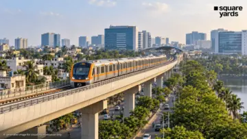
Bengaluru, often referred to as the Silicon Valley of India, is on the cusp of a major infrastructural transformation. The Bangalore Metro Rail Corporation Limited (BMRCL) has recently solidified the roadmap for one of its most ambitious projects to date: the Namma Metro Blue Line. Stretching over 58 kilometers, this corridor is designed to solve two of the city’s most pressing problems—the gridlock on the Outer Ring Road (ORR) and the lack of high-speed mass transit to the Kempegowda International Airport (KIA).
With trial runs scheduled to commence by late 2026, the Blue Line is not just a transit project; it is an economic corridor that will redefine the real estate, commercial, and social landscape of northern and eastern Bengaluru.
1. Main Facts: Defining the Blue Line Corridor
The Namma Metro Blue Line is a massive undertaking divided into two distinct phases: Phase 2A and Phase 2B. Together, they form a continuous 58.19-km elevated corridor that serves as the backbone of the city’s IT and aviation logistics.
Phase 2A: The ORR Tech Corridor
This 19.75-km stretch connects Central Silk Board to KR Puram. It is arguably the most critical section for the city’s economy, as it traverses the Outer Ring Road, which houses some of the world’s largest technology parks, including Embassy TechVillage, Prestige Tech Park, and Manyata Embassy Business Park (further north).
Phase 2B: The Airport Link
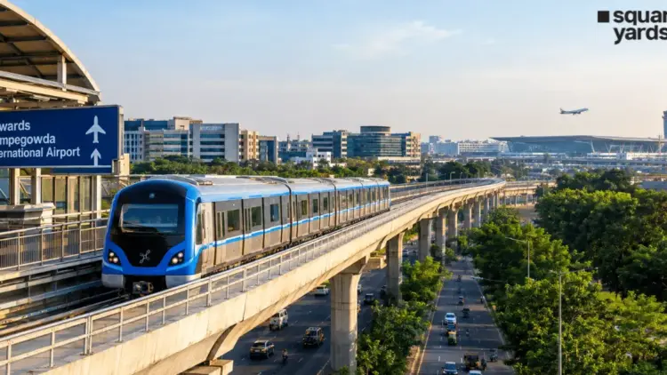
The 38.44-km extension continues from KR Puram, heading north through Hebbal and Yelahanka, eventually terminating at the Kempegowda International Airport. This phase is designed to provide a reliable, traffic-free alternative for travelers who currently rely on the often-congested Bellary Road.
Key Project Specifications
- Total Length: 58.19 km
- Total Stations: 29
- Structure: Primarily elevated, featuring state-of-the-art U-girder technology for faster construction.
- Interchanges: Five major points of intersection with other metro lines.
2. Chronology: The Road to 2028
The timeline for the Blue Line has been meticulously planned to ensure that the most congested areas receive relief first.
- October 2026 (Projected): BMRCL expects to begin trial runs on the Phase 2A section (Central Silk Board to KR Puram). This phase involves testing the signaling systems, track alignment, and the performance of the rolling stock under various load conditions.
- Mid-2027: The first 19.75-km section is targeted for public commissioning. This will provide immediate relief to the lakhs of commuters who navigate the Silk Board and Marathahalli stretches daily.
- Late 2027: Trial runs for Phase 2B (KR Puram to KIA) are expected to commence in stages, starting from the KR Puram end.
- March 2028: The full 58.19-km corridor is expected to be fully operational, allowing a passenger to travel from the southern tip of the ORR to the airport in approximately 75–90 minutes.
The project has faced several hurdles, including land acquisition challenges near Hebbal and the complex engineering required at the Central Silk Board junction, where a multi-level flyover is being integrated with the metro station.
3. Supporting Data: Stations and Interconnectivity
The success of a metro line depends on its ability to "talk" to other lines. The Blue Line is designed as a "hub-and-spoke" integrator.
Key Stations and Their Roles
The 29 planned stations are strategically located at major transit nodes:
- Central Silk Board: The southern terminus and a gateway to the city’s southern suburbs.
- Bellandur & Marathahalli: High-density employment zones.
- KR Puram: A vital multi-modal hub connecting the metro with the Indian Railways network.
- Hebbal: A northern gateway and a major junction for those traveling from the city center.
- KIA Terminals: Dedicated stations for both Terminal 1 and Terminal 2 of the airport.
The Power of Interchanges
The Blue Line will intersect with almost every major line in the Namma Metro network:
- Central Silk Board: Connects to the Yellow Line (RV Road to Bommasandra), providing access to Electronic City.
- KR Puram: Connects to the Purple Line (Whitefield to Challaghatta), linking the east and west of the city.
- Nagawara: Connects to the Pink Line (Kalena Agrahara to Nagawara), facilitating north-south movement through the city center.
- Kempapura & Hebbal: Planned intersections with the Orange Line (Phase 3), which will encircle the city along the western ORR.
4. Official Responses and Strategic Vision
BMRCL officials have emphasized that the Blue Line is more than just a railway; it is a "Transit-Oriented Development" (TOD) catalyst. By increasing the Floor Area Ratio (FAR) along the corridor, the government aims to encourage high-density residential and commercial developments within walking distance of the stations.
"The Blue Line is a top priority because it services the economic engine of Bengaluru," a senior BMRCL official noted in a recent progress briefing. "By connecting the Silk Board junction—one of the city’s most congested points—directly to the airport, we are not just moving people; we are improving the ease of doing business in Karnataka."
Furthermore, the state government has been working closely with international funding agencies like the Asian Development Bank (ADB) and the Japan International Cooperation Agency (JICA) to ensure that the project remains financially viable and adheres to international safety standards.
5. Real Estate Implications: A North Bengaluru Boom
The "Metro Effect" is already visible in Bengaluru’s real estate market. Property values along the ORR and North Bengaluru have seen a steady appreciation since the project’s approval.
Market Insights: Current Pricing Trends
Based on research from Square Yards, the following table illustrates the current real estate landscape along the Blue Line:
| Locality | Average Price (per sq. ft.) | Key Residential/Commercial Drivers |
|---|---|---|
| Bellandur | ₹11,000 – ₹21,000 | Proximity to Embassy TechVillage; high rental demand. |
| Marathahalli | ₹15,000 – ₹20,000 | Mature market; excellent connectivity to Whitefield. |
| HSR Layout | ₹12,000 – ₹17,000 | Upscale residential preference for tech executives. |
| Hebbal | ₹15,000 – ₹18,000 | Luxury high-rises; gateway to the airport. |
| Yelahanka | ₹9,000 – ₹12,000 | Emerging residential hub with large land parcels. |
| Kalyan Nagar | ₹7,000 – ₹9,000 | Mid-segment housing; popular with young professionals. |
Impact on Commercial Spaces
The Blue Line will solidify the Outer Ring Road’s status as the premier office destination in India. With metro access, companies that were previously hesitant to expand due to traffic concerns for their employees are now revisiting their real estate strategies. We are seeing a shift toward "Grade A" office spaces near metro stations like Kadubeesanahalli and Horamavu.
Residential Shift
For residents in HRBR Layout, Kalyan Nagar, and HSR Layout, the Blue Line offers a lifestyle upgrade. It allows professionals to live in quieter, established neighborhoods while enjoying a predictable, air-conditioned commute to their offices in Bellandur or Hebbal.
6. Engineering Marvels and Challenges
Building a 58-km line through some of the busiest roads in India is no small feat. The Blue Line features several engineering highlights:
- The Silk Board Flyover: BMRCL is constructing a road-cum-rail flyover at Central Silk Board. This double-decker structure will allow vehicles to bypass the junction on one level, while the metro runs on the level above.
- Airport Connectivity: Unlike many other Indian cities where the airport metro terminates far from the check-in counters, the Blue Line will have stations integrated directly into the KIA terminal premises, ensuring a seamless "plane-to-train" experience.
- U-Girder Implementation: To meet the 2027-2028 deadlines, BMRCL is using pre-cast U-girders. These are cast at specialized yards and transported to the site at night, allowing for faster spans and minimal disruption to daytime traffic.
7. Conclusion: The Future of Bengaluru’s Mobility
The Namma Metro Blue Line represents the future of Bengaluru—a city that is mobile, interconnected, and globally competitive. By linking the southern tech hubs, the eastern residential clusters, and the northern international gateway, the Blue Line will effectively shrink the city’s perceived distances.
While the wait until 2027 and 2028 may seem long for a city currently struggling with 2-hour commutes, the systematic progress of Phase 2A and 2B offers a light at the end of the tunnel. For investors, it is a golden window for real estate acquisition. For commuters, it is the promise of reclaimed time. For Bengaluru, it is the infrastructure upgrade that finally matches its status as a global technology powerhouse.
As the first U-girders are placed and the stations begin to take shape, the Blue Line is moving from a blueprint to a reality, promising a smoother, faster, and more sustainable future for the Garden City.