By [Your Name/Agency]
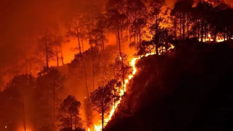
A comprehensive new study spanning two decades has revealed a startling divergence in the fire patterns across India’s most vital ecological landscapes. While the world’s attention often focuses on the catastrophic wildfires of the Amazon or the Australian bush, a quieter but equally significant transformation is occurring within the Indian subcontinent’s protected areas.
Research led by the Centre for Wildlife Studies (CWS) has uncovered a "paradox of fire" across three major Indian landscapes. Between 2002 and 2022, the Eastern Ghats witnessed a staggering 9.3% annual increase in burned areas, while the Western Ghats—a global biodiversity hotspot—saw a surprising 10.8% annual decline. This 20-year analysis, involving 13 wildlife reserves and roughly 20,000 square kilometers of protected forest, highlights a complex interplay between climate change, human activity, and local ecology that defies a "one-size-fits-all" conservation strategy.
Main Facts: A Landscape of Extremes
The study, published in the journal Ecological Solutions and Evidence, provides a granular look at how fire behaves differently depending on the regional "cocktail" of vegetation, climate, and human ignition. The researchers found that the Eastern Ghats now represent India’s most fire-prone landscape among those studied. This region is characterized by a combination of dry deciduous vegetation, frequent droughts, and high levels of human-induced ignition.
In contrast, Central India occupies a middle ground, while the Western Ghats show a cooling trend in terms of total area burned. However, researchers warn that "less fire" is not always "better fire." The ecological health of a forest depends on a specific fire-return interval—the average time between successive fires in the same spot.
Key findings include:
- Eastern Ghats: A fire-return interval of just 14 years, meaning the same patches of forest are burning nearly twice a decade.
- Central India: A fire-return interval of 31 years.
- Western Ghats: A fire-return interval of 92 years, indicating a significant slowdown in fire frequency.
The study utilized two decades of satellite-derived data from NASA’s MODIS (Moderate Resolution Imaging Spectroradiometer) sensor, allowing researchers to track burned areas with high precision across rugged terrains that are often inaccessible to ground teams.
Chronology: Two Decades of Transformation (2002–2022)
The timeline of the study tracks a period of intense environmental and demographic change in India.
The Early 2000s: Establishing the Baseline
In 2002, when the study began, fire management in India was largely reactive, focused on traditional fire-line clearing and suppression. The Western Ghats and Eastern Ghats maintained relatively stable fire regimes, though the impact of anthropogenic climate change was beginning to manifest in more erratic monsoon patterns.
2010–2015: The Divergence
During the middle of the study period, a clear divergence began to emerge. As global temperatures rose, the Eastern Ghats experienced more frequent and severe dry spells. Simultaneously, human encroachment and the use of fire for clearing forest produce or agricultural land intensified in states like Andhra Pradesh and Telangana. Meanwhile, in the Western Ghats, particularly in Karnataka’s flagship parks like Bandipur and Nagarahole, stricter management protocols and a shift toward wetter local conditions began to suppress the total burned area.
2019–2022: The Current Crisis
The final years of the study saw record-breaking fire events. In 2019, Bandipur National Park suffered a massive wildfire that served as a wake-up call for the nation. However, the CWS study indicates that despite such high-profile events, the long-term trend in the Western Ghats remains downward. Conversely, the Eastern Ghats have entered a cycle of "intensifying fires" that are fundamentally altering the flora of the region, favoring fire-resistant invasive species over native timber.
Supporting Data: Drivers of the Flame
The researchers found that human and climate factors explained between 21% and 77% of annual fire activity across the 13 reserves. However, the weight of these factors varied dramatically by geography.

The Human Paradox
One of the most striking findings of the study is how human population density affects fire in different ways.
- In the East: In the Kawal Wildlife Sanctuary (Telangana) and Nagarjunasagar-Srisailam Tiger Reserve (Andhra Pradesh), high human population density was a direct driver of more frequent fires. Here, community fire use—often for the collection of non-timber forest products like Mahua flowers or Tendu leaves—combines with dry conditions to spark widespread blazes.
- In the West: In Nagarahole and Bandipur National Parks (Karnataka), high population densities on the fringes were actually linked with fewer fires. Researchers attribute this to better-funded forest departments, more intensive monitoring, and perhaps a shift in local land-use practices that move away from traditional fire-based clearing.
The Climate Connection
Drought remains a universal catalyst. The study found that while human ignition provides the spark, climate variability determines the "fuel load" and the ease with which a fire spreads. In the Eastern Ghats, the rising temperature and decreasing pre-monsoon rainfall have created a "tinderbox" effect. In the Western Ghats, the 10.8% annual decline in burned area suggests that local factors—including potentially wetter micro-climates or changes in vegetation moisture—are offsetting the pressures of regional droughts.
Official Responses and Expert Insights
Lead author Narendran Kodandapani emphasizes that fire management in India must move away from a centralized, uniform approach.
“Wildfires are ubiquitous across various eco-regions of India. However, each region is characterized by variation in trends, drivers, and ecological challenges,” Kodandapani stated in a press release. “Integrated fire management that accounts for climate, vegetation, and human factors is important for fire management and policy in Indian ecosystems.”
Conservationists from the Centre for Wildlife Studies argue that the current "suppression-only" model used by many forest departments may be insufficient. In the Eastern Ghats, where fires are too frequent, the focus must be on community engagement and reducing ignition sources. However, in parts of the Western Ghats, the lack of fire presents a different kind of threat.
The study suggests that the "paradoxical trend" is fueled by a mix of:
- Forest Management: Varying levels of funding and staffing across state borders.
- Land-Use Change: The conversion of forest fringes to plantations or permanent agriculture.
- Anthropogenic Climate Change: Shifting monsoon cycles and increased "vapor pressure deficit" (dryness of the air).
- Natural Variability: Periodic climate phenomena like El Niño.
Ecological Implications: The Changing Face of the Forest
The biological consequences of these shifting fire regimes are profound and could lead to a permanent transformation of India’s wilderness.
The "Grassification" of the East
In the Eastern Ghats, the rapid fire-return interval (14 years) is preventing native hardwood trees from reaching maturity. When a forest burns every few years, saplings are destroyed before they can develop fire-resistant bark. This creates an opening for fire-resistant grasses, such as Cymbopogon (lemon grass).
Cymbopogon is highly flammable, creating a feedback loop: the grass encourages more fire, which kills more trees, which allows more grass to grow. This "grassification" threatens the habitat of herbivores and the overall carbon sequestration potential of the Eastern Ghats.
The Encroachment Crisis in the West
Conversely, the Western Ghats face the "risk of the quiet." Many of the region’s grasslands are fire-dependent ecosystems. Without periodic, low-intensity fires, woody plants and invasive shrubs begin to encroach on open meadows. These grasslands are essential grazing grounds for India’s largest populations of Asian elephants and Gaurs (Indian Bison). If the grasslands disappear into a thicket of woody shrubs, the carrying capacity of these tiger reserves for large herbivores will plummet.
The Path Forward: Integrated Fire Management
The CWS study concludes that India needs a "reserve-specific deconstruction" of forest fires. Rather than viewing all fire as a disaster, managers must determine the "ideal" fire frequency for their specific landscape.
In the Eastern Ghats, this might mean stricter enforcement against human-started fires during drought years. In the Western Ghats, it may ironically require "prescribed burns" to maintain the health of ancient grasslands.
As India grapples with the dual challenges of a warming planet and a growing population, the lessons from the last 20 years are clear: the fire next time will not be the same everywhere. Understanding the regional nuances of the flame is no longer just a scientific endeavor—it is a requirement for the survival of India’s natural heritage.