

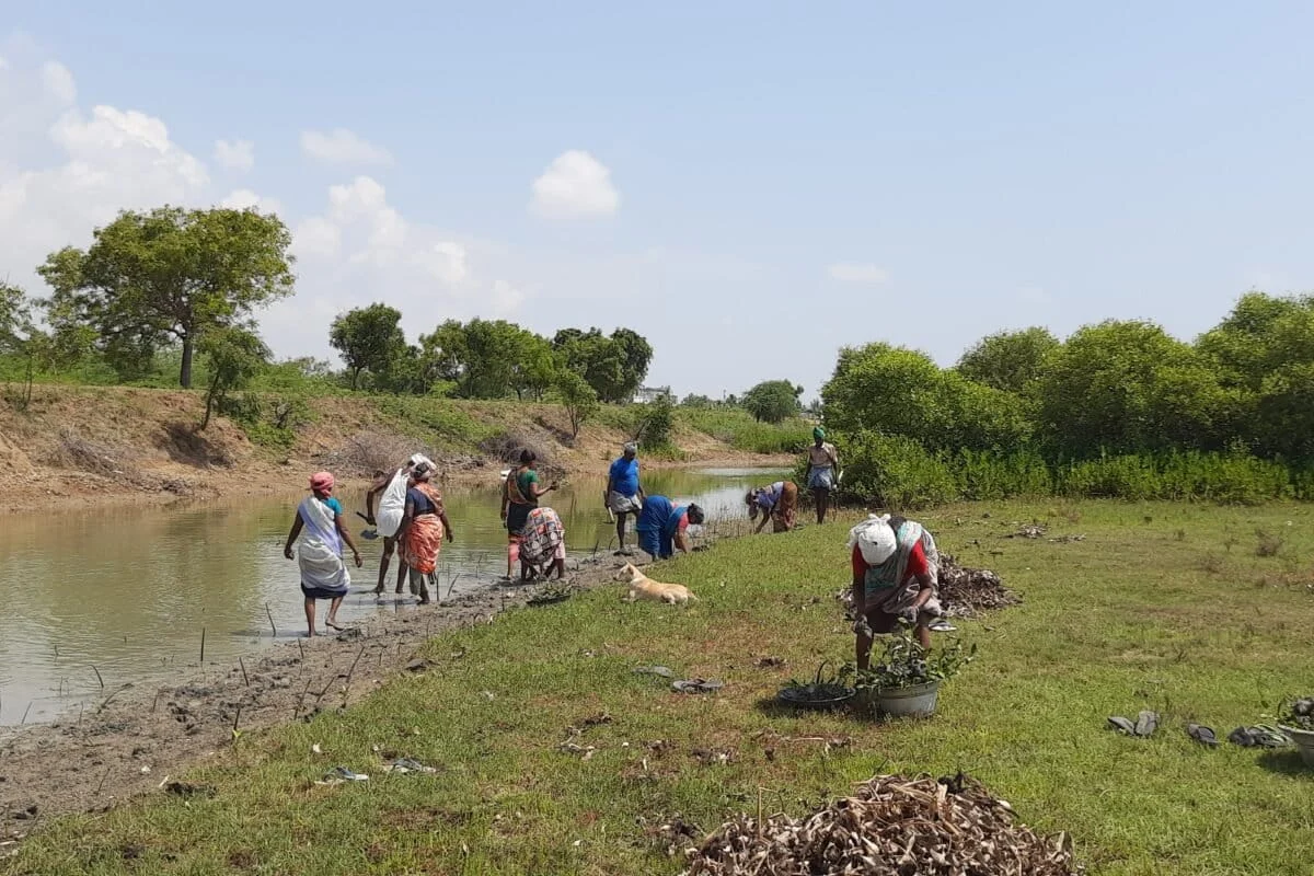
CUDDALORE, TAMIL NADU – In the pre-dawn mist of Kudikadu, a small fishing hamlet nestled along the Uppanar River, the rhythm of conservation is dictated by the tide, not the clock. Before the water rises, a team of local foresters and villagers traverses the muddy expanse of a mangrove nursery. Their equipment is deceptively simple: worn notebooks, lead pencils, and a lifetime of local knowledge. They are not checking GPS coordinates or launching drones; they are counting individual saplings, checking for the tell-tale signs of pest infestations, and noting which species survived the latest spring tide.
This granular, mud-caked labor represents the front line of one of India’s most ambitious environmental projects. However, a growing rift is emerging between the "ground truth" observed by these communities and the "orbital truth" reported by state agencies. As Tamil Nadu positions itself as a global leader in blue carbon and coastal resilience, the debate over how we measure ecological success has become as vital as the restoration itself.
Main Facts: The Great Green Leap
The scale of Tamil Nadu’s reported mangrove expansion is, on paper, nothing short of miraculous. According to a recent assessment by Anna University’s Remote Sensing Department, the state’s mangrove cover has roughly doubled in a staggering three-year window. The report indicates that the area surged from approximately 4,500 hectares (ha) in 2021 to 9,039 ha by 2024.
This data suggests a transformation of the coastline, driven by aggressive plantation drives and enhanced protection measures. According to the official breakdown, the current 9,039-hectare total is comprised of:
![Community-based mangrove monitoring should compliment satellite data [Commentary]](https://imgs.mongabay.com/wp-content/uploads/sites/30/2026/09/22101938/02_Kudikadu_UM-1200x800.jpg)
- Existing Mangrove Forests: 5,414 ha (59.9% of total area).
- New Plantations: 3,625 ha (40.1% of total area).
While these figures have been hailed as a triumph of environmental policy, they have also sparked a fierce debate within the scientific community. Critics argue that such a rapid increase—nearly 100% in 36 months—stretches the biological limits of mangrove growth. The central point of contention is whether the satellite imagery used to derive these figures is capturing genuine ecological recovery or merely "green pixels"—dense clusters of young saplings that may look like a forest from 500 miles up but lack the biodiversity and resilience of a functioning ecosystem.
Chronology: From Local Planting to Global Finance
The journey to this 9,039-hectare milestone reflects a shift in how India views its coastal assets.
- Pre-2021: Mangrove restoration was largely the purview of local NGOs and small-scale forest department initiatives, often focused on specific sites like Pichavaram or Muthupet.
- 2021–2022: The Tamil Nadu government, recognizing the increasing threat of cyclonic storms and rising sea levels, integrated mangrove restoration into its broader Climate Change Mission. Funding began to scale, and the Forest Department began establishing Village Mangrove Councils (VMCs).
- 2023: The central government launched the MISHTI (Mangrove Initiative for Shoreline Habitats & Tangible Incomes) scheme. This coincided with Tamil Nadu securing significant coastal resilience funding from the World Bank. Mangroves were no longer just trees; they became "Blue Carbon" assets.
- 2024: The Anna University report is released, claiming the doubling of cover. This report serves as the primary evidence for the success of recent high-expenditure plantation drives.
This timeline illustrates a transition from "conservation for ecology" to "conservation for climate finance." With hundreds of crores of public and international funds now flowing into the mudflats of Cuddalore, Ramanathapuram, and Nagapattinam, the pressure to show immediate, quantifiable results has never been higher.
Supporting Data: The Limitations of Remote Sensing
Remote sensing is an indispensable tool for modern conservation. It provides a bird’s-eye view of a thousand-kilometer coastline in a single pass, offering a scale and consistency that no human team could replicate. It can flag massive diebacks, track shoreline erosion, and provide a rough estimate of canopy expansion.
However, scientists at the M.S. Swaminathan Research Foundation and other institutions warn that satellites are "blunt instruments" when used in isolation. The limitations of relying solely on pixels include:
![Community-based mangrove monitoring should compliment satellite data [Commentary]](https://imgs.mongabay.com/wp-content/uploads/sites/30/2026/09/22103535/04_Kudikadu_UM-scaled-e1790053562821-768x512.jpg)
- Survival vs. Presence: A satellite can detect green canopy, but it cannot determine if that canopy belongs to a thriving, multi-species forest or a "thin, even-aged stand" of a single species like Avicennia marina. If these monocultures are not maintained, a single bad monsoon or a minor pest outbreak can lead to total dieback—a failure that might not show up on a satellite map for an entire year.
- The Salinity Factor: Mangroves require a delicate balance of fresh and salt water. Upstream aquaculture ponds or irrigation diversions can quietly raise soil salinity. Local villagers notice these changes when they see "yellowing" leaves or stunted growth; a satellite often only registers the change once the tree is already dead.
- Grazing and Pests: Young plantations are highly vulnerable to cattle and goats. While a VMC member can see a patch of saplings being nibbled away in real-time, a satellite sees a "green area" until the canopy density drops below a specific threshold.
- Ecological Function: A "successful" restoration isn’t just about area; it’s about function. Are the tidal canals flowing? Is the biodiversity returning? Is the forest sequestering carbon at the predicted rate? These are ground-level realities that require human observation.
Official Responses and the VMC Framework
In response to the need for better data, the Tamil Nadu Forest Department has pioneered the Village Mangrove Council (VMC) model. These are registered societies led by a village president and a forest range officer.
Official sources within the Forest Department acknowledge that while satellite data provides the "macro" view, the VMCs are the "nervous system" of the restoration project. These councils are responsible for:
- Operating and maintaining nurseries.
- Executing the physical planting of propagules.
- Desilting tidal canals to ensure proper water flow.
- Protecting young plants from grazing and human interference.
"The people are not just labor; they are partners," says a representative involved in the Cuddalore restoration efforts. "They notice a dying sapling long before it registers as a change in canopy reflectance. They know which creek mouth silts up after heavy rain because they have watched it for decades."
The government is now under pressure from international donors, including the World Bank, to formalize this community feedback. Auditors and scientists are calling for a standardized protocol where community-collected observations—geotagged photos of sapling survival, salinity readings, and pest reports—are integrated into the same digital architecture used for satellite classification.
Implications: A Blueprint for the Blue Economy
The stakes of the Tamil Nadu experiment extend far beyond the Uppanar River. As the world turns to "Blue Carbon" to offset industrial emissions, the integrity of restoration data has become a financial necessity. If a state claims carbon credits based on a doubling of mangrove cover, that data must be beyond reproach.
![Community-based mangrove monitoring should compliment satellite data [Commentary]](https://imgs.mongabay.com/wp-content/uploads/sites/30/2026/09/22103951/01_Kudikadu_UM-e1790053812720-768x512.jpg)
1. The Credibility of Climate Finance:
If restoration numbers are perceived as "inflated" or based on "green pixels" rather than surviving forests, it undermines the state’s ability to attract future climate finance. Transparent, ground-verified monitoring is the only way to satisfy international auditors and carbon market regulators.
2. Empowerment vs. Employment:
The current model often treats villagers as "plantation labor." Transitioning them to "scientific partners" changes the power dynamic. When a VMC can see their own data compared to a neighboring village on a mobile app, their sense of ownership over the ecosystem grows. This "social fencing" is far more effective at protecting forests than any government regulation.
3. A Model for India’s Coastline:
From the Sundarbans in West Bengal to the backwaters of Kerala, India’s coastal states are watching Tamil Nadu. The integration of community-based monitoring (CBM) with high-resolution satellite data could become the national standard for the MISHTI scheme. It offers a way to scale restoration quickly without sacrificing ecological or data integrity.
Conclusion: The Satellite and the Mud
Ultimately, the success of Tamil Nadu’s mangrove mission will not be decided in a laboratory in Chennai or a boardroom in Washington D.C. It will be decided in the mud of Kudikadu.
As the state scales up its ambitions, it faces a rare opportunity to build a monitoring system that is "shore-verified." This approach acknowledges a simple truth: restoration is not just about planting trees; it is about ensuring they stay alive. To get that answer right, the state needs both the sophisticated eye of the satellite and the calloused hands of the people standing beneath it.
![Community-based mangrove monitoring should compliment satellite data [Commentary]](https://imgs.mongabay.com/wp-content/uploads/sites/30/2026/09/22104104/05_Kudikadu_AA-768x512.jpeg)
The goal is a coastline that is not just green on a map, but resilient in reality—a bio-shield that can withstand the storms of the future because it was nurtured by the people who call the coast their home.
