

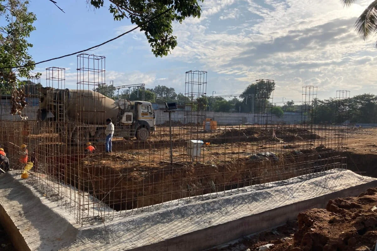
BENGALURU — In a city synonymous with both technological prowess and crippling traffic, a proposed 2.2-kilometer tunnel road at the Hebbal Junction has become the latest flashpoint in the struggle between rapid infrastructure development and environmental preservation. Designed to decongest one of North Bengaluru’s most notorious bottlenecks, the project is now under intense scrutiny from urban planners, environmentalists, and the judiciary.
The proposed three-lane, bidirectional tunnel, estimated to cost ₹1,385 crore (approximately $165 million), represents an eye-watering investment of ₹622 crore per kilometer. However, as groundwork begins, a growing chorus of experts warns that the project may not only fail to solve the traffic crisis but could also inflict irreparable damage on the city’s fragile hydrological health, specifically targeting the historic Hebbal Lake.
Main Facts: A Project Under the Microscope
The Hebbal tunnel road is envisioned as a strategic intervention to streamline the flow of traffic between Kempegowda International Airport and the city center. Hebbal Junction currently serves as a massive interchange where the Outer Ring Road, Bellary Road, and several local arteries converge, often leading to hours of gridlock.
Key project specifications include:

- Total Length: 2.2 kilometers.
- Structure: Three-lane, bidirectional road.
- Methodology: "Cut-and-cover" excavation rather than deep-rock boring.
- Depth: 18.5 meters (approximately 60 feet) below the surface.
- Cost: ₹1,385.29 crore.
- Executing Agency: Bangalore Development Authority (BDA).
Despite these ambitious plans, the project is mired in controversy. Critics argue that the Detailed Project Report (DPR) itself reveals the tunnel’s obsolescence before it is even completed, suggesting it will reach full capacity by 2047. Furthermore, its proximity to Hebbal Lake—a 141-acre water body vital for groundwater recharge—has triggered a Public Interest Litigation (PIL) in the Karnataka High Court.
Chronology: From Blueprint to Legal Battle
The trajectory of the Hebbal tunnel project reflects the typical "fast-track" approach of Bengaluru’s infrastructure development, often at the expense of public consultation and environmental vetting.
- Early 2024: The Bangalore Development Authority (BDA) finalizes the plan for a short tunnel to bypass the Hebbal flyover congestion points.
- July 2024: The Union Environment Ministry clarifies that standalone tunnels do not automatically require a prior Environmental Impact Assessment (EIA) under the 2006 notification, providing a legal loophole for the project to proceed without rigorous environmental clearance.
- August 2024: Groundwork commences within the Karnataka Veterinary, Animal and Fisheries Sciences University (KVAFSU) campus. Simultaneously, a PIL is filed in the Karnataka High Court seeking a stay, citing the lack of hydrological and groundwater impact studies.
- August 6, 2024: The Karnataka High Court directs the state government to file an affidavit clarifying whether any studies were conducted regarding the project’s impact on Hebbal Lake’s inflow and outflow.
- Late August 2024: The Karnataka Tank Conservation and Development Authority (KTCDA) transfers approximately 3.3 acres of Hebbal Lake land to the BDA for the project, despite the lake’s protected status.
- September 3, 2024: The High Court notes a geotechnical report claiming the lake’s water flow will not be affected but demands a formal presentation by engineers to explain the technical safeguards in place.
Supporting Data: Traffic Shifts and Hydrological Risks
To understand the opposition, one must look at the data provided by independent researchers and the BDA’s own documentation.
The "Congestion Shift" Phenomenon
An analysis by the Sustainable Transportation Lab at the Indian Institute of Science (IISc) suggests that the tunnel is a "highly localized improvement." According to Satya Arikutharam, an urban mobility expert, the tunnel merely accelerates the rate at which vehicles reach the next bottleneck. "Faster arrival rates at local road intersections mean quicker accumulation of traffic, queuing pile-ups, and traffic jams," Arikutharam explains. The IISc study concludes that the tunnel "merely shifts the congestion point," leaving the entry and exit zones in a state of perpetual gridlock.

The Lake Cascade System
Bengaluru’s lakes are not isolated ponds; they are part of a centuries-old "cascading" system. Hebbal Lake sits in the middle of the Hebbal-Nagavara valley cascade.
- Inflow: Receives water from upstream lakes like Doddabommasandra.
- Outflow: Feeds downstream into Nagavara and Kalkere.
A 2022 study by the Ashoka Trust for Research in Ecology and the Environment (ATREE) found that only 32 of the 72 lakes in this valley have functioning channels. Disrupting Hebbal Lake further risks flooding in low-lying areas like the Manyata Tech Park region, which already struggles with monsoon discharge.
Groundwater Depletion
The project area falls within the Yelahanka taluk, which the Central Ground Water Board (CGWB) classified as "overexploited" in 2025. With average borewell depths reaching 800 to 1,200 feet, any disruption to the shallow aquifer—the soil and weathered rock layers in the top 60 feet—could be catastrophic. The tunnel’s "tanked" (watertight) design effectively creates a concrete wall in the earth, potentially blocking the lateral movement of groundwater that replenishes local wells.
Official Responses: The Defense of Development
The Bangalore Development Authority and other state bodies maintain that the project is both necessary and scientifically sound.
Yashwantha Kumar M., Executive Engineer, BDA:
Kumar argues that the BDA has indeed undertaken hydrological studies, though these have not been released for public scrutiny. He characterizes the ₹75 lakh earmarked in the DPR for an EIA as a "budgetary provision" that can be utilized at any stage. He emphasizes that as a 2.2-km standalone project, it does not legally require central government environmental clearance.

The BDA’s Technical Stance:
The BDA asserts that the "cut-and-cover" method will include temporary barriers (cofferdams) and continuous dewatering during construction to manage groundwater. Once finished, the tunnel will feature sump pumps and flood barriers to prevent it from becoming a subterranean canal during Bengaluru’s increasingly frequent intense rain events.
The KTCDA’s Land Transfer:
The Karnataka Tank Conservation and Development Authority justified the transfer of 3.3 acres of lake land by stating that the "physical structure and natural inflow and outflow" of the lake would remain undisturbed. This claim, however, is contested by experts who point out that the land being "converted" for the tunnel includes the lake’s vital buffer zone.
Implications: A Gamble on Bengaluru’s Future
The Hebbal tunnel project exposes a deeper malaise in Bengaluru’s urban planning: fragmented governance and a car-centric development philosophy.
Fragmented Governance
While one arm of the government (the Greater Bengaluru Authority) spends ₹20 crore to rejuvenate Hebbal Lake and increase its water-holding capacity, another arm (the BDA) is encroaching upon the lake’s buffer zone for a road project. T.V. Ramachandra of the IISc’s Centre for Ecological Sciences calls this "fragmented governance," where departments work at cross-purposes, ultimately reducing the city’s resilience to climate change.

The Erosion of Buffer Zones
Under the recently amended Karnataka Tank Conservation and Development Authority Act, 2025, a 30-meter buffer zone is mandatory for lakes like Hebbal. By allowing the tunnel to sit within 8-12 meters of the lake boundary, the state is setting a precedent that buffer zones—which act as natural floodplains and groundwater recharge pits—are negotiable.
Long-term Economic and Ecological Costs
At ₹622 crore per kilometer, the opportunity cost of the tunnel is staggering. Urbanists argue that the same funds could significantly enhance the city’s bus-priority lanes or suburban rail connectivity, which move more people with a smaller environmental footprint.
Furthermore, the "watertight" nature of the tunnel may solve the immediate problem of keeping drivers dry, but it creates a permanent barrier in the subsurface. As Shashank Palur of WELL Labs notes, "We don’t know what the lasting consequences of stopping the east-to-west movement of groundwater will look like."
Conclusion
As the Karnataka High Court continues to deliberate on the PIL, the Hebbal tunnel project remains a symbol of the tension between a city’s desire for speed and its need for sustainability. If the project proceeds without a transparent, comprehensive hydrological impact assessment, Bengaluru may find that its ₹1,385 crore "solution" to traffic has only deepened its water and flooding crises. The city’s lakes, once its lifeline, are increasingly being treated as obstacles to be bypassed, rather than the essential infrastructure they truly are.
