
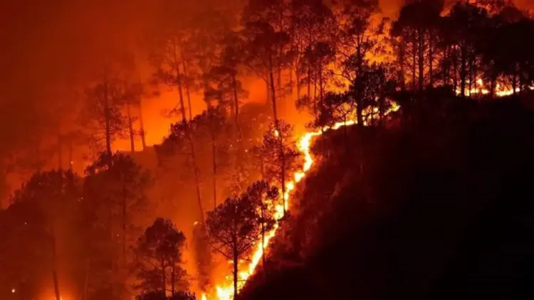
New research led by the Centre for Wildlife Studies (CWS) has unveiled a stark and diverging reality for India’s forest ecosystems. While global attention often focuses on the massive wildfires of the Amazon or the Australian bush, a quieter but equally significant transformation is occurring within the Indian subcontinent. According to a comprehensive study published in the journal Ecosphere, the fire regimes of India’s wildlife reserves are undergoing a dramatic shift, with the Eastern Ghats emerging as a burgeoning hotspot for frequent blazes, while the Western Ghats experience a surprising decline in burned areas.
The study, which meticulously tracked fire activity over a 20-year period from 2002 to 2022, highlights the complex interplay between climate change, human activity, and local ecology. As the Eastern Ghats face a 9.3% annual increase in burned area, researchers warn that the very fabric of these forests is changing, threatening biodiversity and the survival of native species.
Main Facts: A Tale of Three Landscapes
The study, spearheaded by lead author Narendran Kodandapani and researchers from the Centre for Wildlife Studies, focused on approximately 20,000 square kilometers of protected forest land. This vast expanse encompasses 13 prominent wildlife reserves across three distinct ecological zones: the Eastern Ghats, the Western Ghats, and Central India.
The primary findings reveal a geographical "tug-of-war" in fire trends:
- The Eastern Ghats: This region has become the most fire-prone, with the burned area increasing at an alarming rate of 9.3% per year.
- The Western Ghats: Conversely, this biodiversity hotspot saw a significant decline in fire activity, with the burned area shrinking by 10.8% annually.
- Central India: This region occupies a middle ground, showing more stability but still facing unique pressures from both human and climatic drivers.
To reach these conclusions, the research team utilized high-resolution satellite data from NASA’s MODIS (Moderate Resolution Imaging Spectroradiometer) sensor. By analyzing burned-area data over two decades, they were able to calculate the "fire-return interval"—the average number of years between successive fires in the same location. The results were startling: the Eastern Ghats now have a fire-return interval of just 14 years, compared to 31 years in Central India and a much longer 92 years in the Western Ghats.
Chronology: Two Decades of Environmental Transformation (2002–2022)
The study spans a critical period in India’s environmental history, marked by rapid economic growth, shifting agricultural practices, and the intensifying effects of anthropogenic climate change.
The Early 2000s: The Baseline
At the turn of the millennium, fire management in India was largely characterized by traditional suppression techniques. While fires were known to be a part of the landscape, the frequency and intensity varied wildly based on local weather patterns. The 2002 start date of the study provides a baseline before the most severe impacts of 21st-century global warming began to manifest consistently in regional data.
2010–2015: The Emergence of the Divide
Midway through the study period, a clear divergence began to appear. In the Eastern Ghats, a combination of prolonged dry seasons and increased human encroachment began to prime the landscape for more frequent ignitions. In contrast, parts of the Western Ghats began to see "wetter" trends or shifts in land-use management that started to suppress the traditional fire cycle.
2019–2022: Recent Intensification
The final years of the study saw some of the most extreme fire seasons on record. Notable events, such as the 2019 fires in Bandipur National Park, served as a grim reminder of the volatility of these ecosystems. However, the study confirms that while individual "mega-fires" grab headlines, it is the underlying annual trend—the steady 9.3% rise in the East—that poses the greatest long-term ecological threat.
Supporting Data: Drivers and Regional Disparities
The researchers found that the variation in fire activity across individual reserves could be explained by a mix of human and climate factors, accounting for between 21% and 77% of the annual fire activity.
The Human-Climate Nexus
Drought was identified as a primary climatic driver, but its impact was heavily mediated by human presence. In many Indian landscapes, fire is used as a tool for clearing forest undergrowth, encouraging the growth of fresh fodder for livestock, or collecting non-timber forest products like Mahua flowers.
However, the study uncovered a "population paradox." In the Kawal Wildlife Sanctuary (Telangana) and the Nagarjunasagar-Srisailam Tiger Reserve (Andhra Pradesh), high human population density was strongly associated with a higher frequency of fires. Proximity to human settlements in these regions directly correlated with more frequent ignition events.

In contrast, the Nagarahole and Bandipur National Parks in Karnataka showed the opposite trend. Despite having similar or even higher human population pressures, these reserves were linked with fewer fires. Researchers suggest this could be due to more intensive forest management, better-funded fire-fighting infrastructure, or changes in how local communities interact with the forest.
Fire-Return Intervals and Vegetation
The data on fire-return intervals provides the clearest picture of the ecological pressure:
- Eastern Ghats (14 years): Such a short interval prevents many native tree species from reaching maturity or successfully regenerating, as saplings are destroyed before they can develop fire-resistant bark.
- Central India (31 years): A moderate interval that allows for some recovery but remains sensitive to climatic shifts.
- Western Ghats (92 years): A long interval that suggests a move toward "fire-starved" conditions in some areas, which brings its own set of ecological challenges.
Official Responses and Researcher Insights
The lead author of the study, Narendran Kodandapani, emphasized that fire management in India cannot be governed by a single, nationwide policy.
"Wildfires are ubiquitous across various eco-regions of India. However, each region is characterized by variation in trends, drivers, and ecological challenges," Kodandapani stated. He argued that the current data necessitates an "Integrated Fire Management" approach—one that balances the needs of local communities with the specific climatic and vegetative requirements of the landscape.
The study also points out that the paradoxical trends in burned areas are likely fueled by a "cocktail" of factors. The researchers noted: “Various factors could be contributing to this paradoxical trend… including forest management, land-use change, changes in fire ignitions, anthropogenic climate change, and natural climate variability.”
Wildlife conservationists have expressed concern that the current "one-size-fits-all" approach to fire—which often focuses solely on total suppression—might be failing because it ignores the regional nuances revealed by the NASA MODIS data.
Implications: The Ecological Cost of Shifting Flames
The shifting fire regimes are not merely statistical curiosities; they are actively reshaping the biology of the Indian subcontinent.
The Rise of Invasive Grasses in the East
In the Eastern Ghats, the high frequency of fire is facilitating a "grass-fire cycle." Frequent blazes favor fire-resistant, invasive grasses like Cymbopogon. These grasses burn easily and intensely, further increasing the likelihood of future fires. This cycle creates "regeneration challenges" for native hardwood trees, potentially transforming diverse forests into degraded scrublands or monocultural grasslands over time.
Woody Encroachment in the West
Conversely, the Western Ghats face a different threat. The 10.8% annual decline in burned areas might seem like a positive development for forest cover, but it poses a risk to "open natural ecosystems" (ONEs). Without occasional, low-intensity fires to keep them in check, woody plants and invasive shrubs can encroach upon open grasslands. These grasslands are vital for large herbivores like Gaur (Indian Bison) and various species of deer. If the grasslands disappear, the entire food chain—up to apex predators like tigers and leopards—could be disrupted.
Policy and Management Challenges
The study’s findings suggest that Indian forest policy must evolve. In the Eastern Ghats, the priority must be on reducing human-caused ignitions and breaking the grass-fire cycle. In the Western Ghats, managers may need to consider "prescribed burns" to maintain the health of grassland ecosystems, a practice that remains controversial and legally complex in India.
Ultimately, the research from the Centre for Wildlife Studies serves as a call to action. As climate change continues to alter rainfall patterns and temperature regimes, the "old rules" of forest management are no longer sufficient. To protect India’s remaining wilderness, the study suggests that policy must become as dynamic and regionally specific as the fires themselves. Without a nuanced approach that accounts for the 14-year fire cycle in the East and the 92-year cycle in the West, the country risks losing the very biodiversity these protected areas were designed to save.