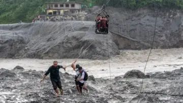
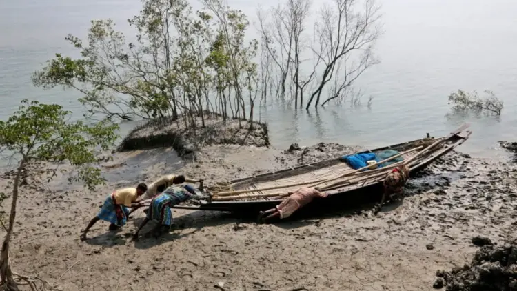
At the confluence of the Ganga, Brahmaputra, and Meghna rivers lies the world’s largest contiguous mangrove forest: the Sundarbans. This vast, amphibious delta, spanning the borders of India and Bangladesh, is a landscape defined by flux. It is a realm where the boundary between land and sea is never fixed, where the tides dictate the rhythm of life, and where one of the most biodiverse ecosystems on Earth is currently fighting a losing battle against the rising tide of climate change.
As sea levels rise at nearly three times the global average, the Sundarbans has become a global flashpoint for environmental displacement. With millions of lives hanging in the balance, the region stands as a grim harbinger of the "climate refugee" crisis that threatens coastal populations worldwide.
Main Facts: A Global Treasure Under Siege
The Sundarbans, which derives its name from the Sundari tree (Heritiera fomes), covers approximately 10,000 square kilometers. India holds about 40% of this territory, with the remaining 60% situated in Bangladesh. Recognized as a UNESCO World Heritage site across four protected areas—Sundarbans West, South, and East in Bangladesh, and Sundarbans National Park in India—the delta is a critical bastion of biodiversity.
A Nursery for the Bay of Bengal
The nutrient-rich waters of the mangrove forest serve as a vital nursery for approximately 90% of the aquatic species found along India’s eastern coast. This productivity is driven by the unique "interpenetration" of fresh and salt water. In his 2004 novel The Hungry Tide, author Amitav Ghosh describes these waters as a collection of "floating biodomes," where variations in salinity and turbidity create hundreds of distinct ecological niches. These niches support everything from microscopic fish to gargantuan crocodiles and the endangered Royal Bengal tiger.

The Dolphin Sanctuary
The Sundarbans is one of the few places on Earth where the populations of the Ganges River dolphin and the Irrawaddy dolphin overlap. This concentration of threatened aquatic mammals is made possible by the dynamic mixing of freshwater from the great Himalayan rivers with the saline surge of the Bay of Bengal. However, this delicate balance is being upended by anthropogenic factors, including damming and climate-driven sea-level rise.
Chronology: The Making of a Delta
To understand the current crisis, one must look back millions of years to the geological "engineering" that created the Bengal Delta.
The Tertiary Period and the Himalayan Uplift
Between 66 million and 2.6 million years ago, the rising Himalayas fundamentally altered the geography of South Asia. This tectonic upheaval established the monsoon regime and birthed the great river systems that carry massive volumes of sediment from the mountains to the sea. This sediment is the literal "building block" of the Sundarbans.
The Early Holocene Transgression (11,000–7,000 years ago)
Following the last Ice Age, the rapid melting of glaciers caused a global rise in sea levels. During this period, the sea advanced far inland into the Bengal Basin. Because the water rose faster than the rivers could deposit sediment, the area remained an open marine environment rather than a forest. Geologists refer to this as a phase of "accommodation space," where the underwater volume was too vast for land to form.

Stabilization and Progradation (5,000–2,000 years ago)
The modern Sundarbans began to take shape roughly 5,000 years ago when the rate of sea-level rise slowed. This allowed the sediment from the Ganga and Brahmaputra to finally outpace the ocean. The delta began to "prograde" or build outward, creating the low-lying mudflats and estuaries where mangroves could finally take root.
The Eastward Shift and Colonial Intervention
Over the last millennium, tectonic tilting has gradually shifted the primary flow of freshwater toward the east (Bangladesh). This left the western (Indian) side of the delta "fluvially abandoned," making it increasingly dependent on tidal processes. During British colonial rule, and later following the Partition of India in 1947, the region became a refuge for displaced laborers and migrants seeking land and security, setting the stage for the high population density seen today.
Supporting Data: The Rising Tide in Numbers
The ecological emergency in the Sundarbans is supported by sobering data from satellite imagery and ground-level research.
- Sea Level Rise: Data from NASA’s Landsat imagery indicates that sea levels in the Sundarbans are rising at an average rate of 3 centimeters per year. This is significantly higher than the global average, compounded by regional land subsidence.
- Shoreline Loss: Over the last 40 years, the region has lost approximately 12% of its shoreline to severe coastal erosion.
- Salinity Spikes: The construction of the Farakka Barrage and other upstream interventions has reduced the flow of freshwater into the delta. During the summer months, salinity levels soar to dangerous highs, killing off the Sundari trees and rendering agricultural land barren.
- Human Impact: The region is home to between 7 and 7.5 million people (4.5 million in India and 2.7 million in Bangladesh). A post-cyclone survey revealed that 510 out of every 1,000 residents—primarily children—suffer from malnutrition or waterborne illnesses.
Official Responses: Policy Gaps and Legal Limbo
Despite the scale of the crisis, official responses have often been criticized as reactive rather than proactive.

The Refugee Vacuum
One of the most pressing issues is the lack of legal standing for "environmental migrants." Under international treaty law, those displaced by rising seas do not qualify as refugees. In India, national disaster risk policies are geared toward immediate relief following extreme weather events, such as cyclones, but they offer no long-term support or compensation for those whose land has permanently disappeared beneath the waves.
Conservation vs. Survival
There is a profound tension between conservation efforts and the survival of local communities. While the creation of Tiger Reserves and protected areas is essential for biodiversity, these policies often restrict the livelihoods of traditional fishermen and honey collectors. As Amitav Ghosh notes, the impulse to protect the environment frequently collides with the urgent need of the "hungry" to eat.
The Farakka Factor
The Indian government’s management of freshwater via the Farakka Barrage remains a point of contention with Bangladesh. The reduction in freshwater flow has not only increased salinity but has also diminished the sediment supply needed to stabilize the islands against erosion.
Implications: The Future of "Amphibious Living"
The Sundarbans stands at a crossroads. The traditional way of life—farming and fishing on fixed islands—is becoming increasingly untenable.

The ALO Framework
Researchers are now proposing a transition to "Amphibious Living Opportunities" (ALO). This framework suggests that instead of fighting the water with fragile embankments, communities should adapt to it. This includes:
- Resilient Architecture: Building houses on stilts or floating platforms that can rise with the tide.
- Salt-Tolerant Agriculture: Moving away from traditional paddy toward salt-tolerant crops and "aquaponics."
- Climate-Adapted Fisheries: Transitioning to brackish-water aquaculture that thrives in higher salinity.
A Global Warning
The implications of the Sundarbans’ fate extend far beyond the Bay of Bengal. As a low-lying delta, it is a "canary in the coal mine" for other coastal regions, from the Mekong Delta to the Mississippi. If a region as vast and ecologically significant as the Sundarbans cannot be stabilized, it bodes ill for the hundreds of millions of people living in coastal zones worldwide.
Conclusion: A Test of Coexistence
The Sundarbans is more than just a forest; it is a living chronicle of human and animal resilience. However, that resilience has a breaking point. The "Hungry Tide" is no longer a literary metaphor; it is a daily reality for millions. The survival of this extraordinary delta will depend on whether the international community can move beyond "disaster relief" toward a sustained investment in climate adaptation and a legal framework that recognizes the rights of those displaced by a changing planet.
As the sea continues its relentless advance, the Sundarbans poses a haunting question to the world: Can we find a way to coexist with a nature that both gives life and, with increasing frequency, takes it away?